



News
Viking Link - USV Environmental Survey
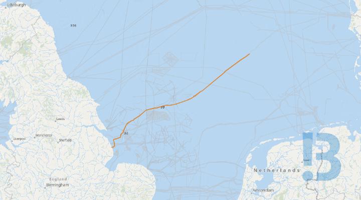
Please be advised that on behalf of National Grid Ventures, Fugro is planning to conduct an environmental camera survey in the North Sea from the nearshore limit north the Viking Link cable, northeast of Mablethorpe, Lincolnshire, (53° 28.2’N 000° 29.7’ E) and extending offshore to the UK / Netherlands border. The work will be conducted by the un-manned survey vessel (USV), Blue Eclipse, operated from a remote operations centre in Aberdeen.
Seabed video and photography data will be acquired using the eROV mounted camera system deployed from the USV Blue Eclipse.
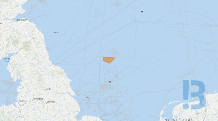
The survey works shall provide seabed imagery along 193 selected 100m transects along the route illustrated in figure 1.1
As the Blue Eclipse will be station keeping with an ROV deployed, the vessel will be restricted in its ability to manoeuvre.
All vessels operating within this area are requested to keep their distance, maintaining at least the 500m safety zone around the survey vessel, and pass at minimum speed to reduce vessel wash.
A continuous listening watch will be conducted on VHF Channel 16.
See detailed map on our bulletin website
Galloper Wind Farm - JUV Operations
Please be advised that Galloper Windfarm will be carrying out a major component exchange from the Jack Up Vessel (JUV) WIND ENERGY in the South Galloper Field on one WTG GS-D3J Planned Dates: 19th November 2026 for approx. 1 week - subject to weather
Please be advised that Galloper Windfarm will be carrying out a major component exchangefrom the Jack Up Vessel (JUV) WIND ENERGY in the South Galloper Field on one WTG GS-D3J
Planned Dates: 19th November 2026 for approx. 1 week - subject to weather
An exclusion zone of 500m is required around the JUV
JUV - ZITON WIND ENERGY
See detailed map on our bulletin website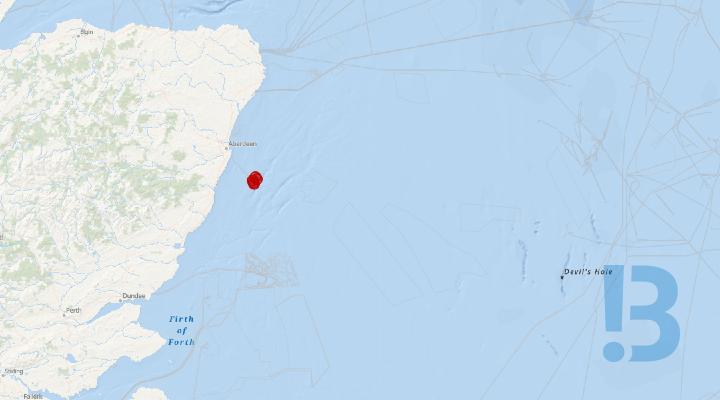
Kincardine Offshore Wind Farm - Notice of Fog Horn Outage
Please be aware, one of the five fog horns on the assets at the Kincardine wind farm is inoperable at the present time (KIN-05). Replacement parts required have a long lead time but it is anticipated repairs should be completed by early December 2026. In the meantime, seafarers are asked to continue to take care when navigating the area in poor visibility.
Please be aware, one of the five fog horns on the assets at the Kincardine wind farm is inoperable at the present time (KIN-05). Replacement parts required have a long lead time but it is anticipated repairs should be completed by early December 2026. In the meantime, seafarers are asked to continue to take care when navigating the area in poor visibility.
See detailed map on our bulletin website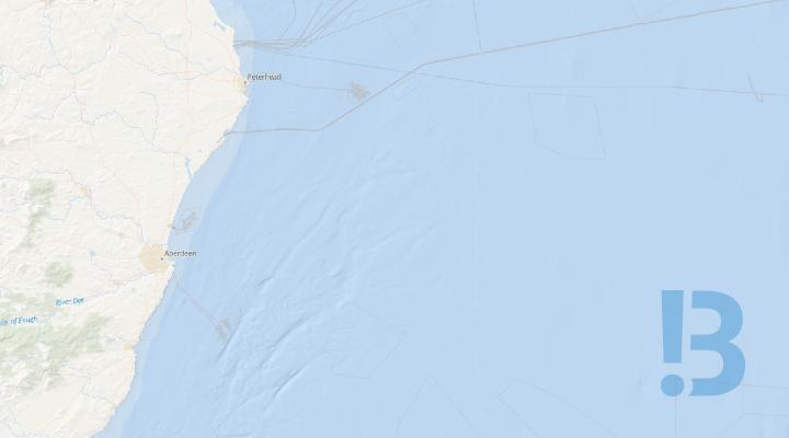
Vattenfall Offshore Wind Farm - Exposed Export Cable
During a routine inspection of the export cables (ECR A & ECR B) , two sections of the cables were found to be partially exposed through the boulder field. This may constitute a hazard to activities such as fishing and anchoring
It is requested that mariners avoid activities which are likely to disturb the seabed within a 500m Radius of this location until the exposed export cable has been re-investigated. A further Notice to Mariners will be issued to confirm the course of action we will be taking to rectify this. Please note that the standard safety rules apply when fishing in or near wind farms and associated cables. All mariners are requested to make themselves aware of their obligations for conducting activities over buried and protected cables under International and UK Cable (Sub-sea) Protection Legislation.
Mariners are reminded to navigate with caution and keep continued watch on VHF Ch. 12 / 16 when navigating the area. The Marine Coordination Centre will be responsible for monitoring and policing the Safety Zone and can be contacted directly for advice. Further information on the risks to fishing adjacent to subsea cables can be found on www.kis-orca.org
See detailed map on our bulletin website
Dogger Bank A, B, C Navigation Warning Boundary Buoy
Mariners are advised of the following defects that have been reported on the below listed Dogger Bank A, B and C construction area(s) boundary demarcation buoys:
|
Aid To Navigation |
Position |
Aid Type |
Defect |
|
DOGA Foxtrot (SP6) |
54° 50.612' N 002° 04.734' E |
Special Mark |
Unlit Topmark missing Daymark missing |
|
DOGB East (E1) |
54° 52.116' N 001° 52.166' E |
East Cardinal |
Topmark missing |
|
DOGB North (N2 |
55° 06.289' N 001° 40.488' E |
North Cardinal |
Unlit |
|
DOGC S1 |
54° 57.020' N 002° 57.366' E |
South Cardinal |
Topmark missing |
See detailed map on our bulletin website
Hornsea 3 Offshore Windfarm - Construction Activities
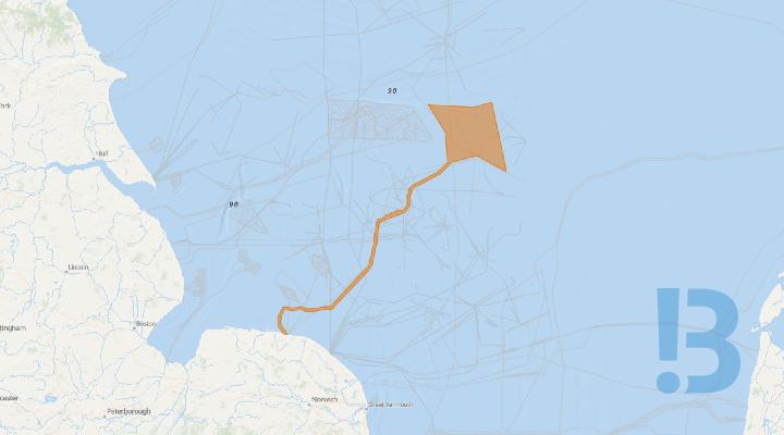
Notice to Mariners for construction activities associated with Hornsea Project Three Offshore Wind Farm. This notice will be updated weekly to provide insights into the project's activities throughout the construction phase.
Show More
Offshore Construction - Dogger Bank A Offshore Wind Farm
Offshore Construction of the Dogger Bank A Offshore Wind Farm commenced on the 18th of March 2022. The development of the windfarm is made up of several elements - current ongoing elements are described below in the 'full notice' and in the attached file. This notice will be updated weekly, giving information on the progress and resources involved in the offshore project.
The development of the windfarm is made up of several elements - current ongoing elements include:
Construction Support Activities
The Offshore Construction Support Vessels Norwind Vestri, Grampian Tyne, Grampian Tweed, Windea Carnot, Windea Clarke, Grampian Derwent and Grampian Tay will continue with ongoing construction support activities within Dogger Bank A construction site.
See detailed map on our bulletin website
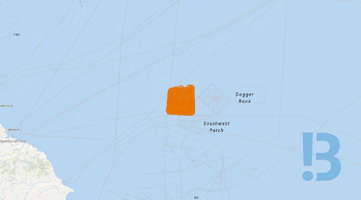
Offshore Construction - Dogger Bank B Offshore Wind Farm
Offshore Construction of the Dogger Bank B Offshore Wind Farm commenced on the 21st of April 2023 with the installation of the OSP jacket foundation. This notice will be updated weekly, giving information on the progress and resources involved in the offshore project. The intention is to give an overview of activities and vessels involved. Should anyone have questions regarding the operations, we kindly ask you to put them forward well in advance.
Construction Support Activities
The Offshore Construction Support Vessel IWS Skywalker will continue with ongoing construction support activities within Dogger Bank B construction site.
Wind Turbine Generator (WTG) Installation
he Jack-up WTG Installation Vessel, Seaway Ventus will continue installation of wind turbine generators (WTG) within the Dogger Bank B construction area. The works commencing in February 2026, and will be continuous, 24 hours a day, for the duration of the WTG installations.
The ERRV Esvagt Castor will provide support for helicopter crew changes at the Dogger Bank OffshoreWindfarm
During operations,all vessels will be restricted in their ability to manoeuvre as defined under COLREGs (International Regulations for Preventing Collisions at Sea 1972) and will display the appropriate day shapes and lights. The vessels will also transmit an Automatic Identification System (AIS) message.
See detailed map on our bulletin website
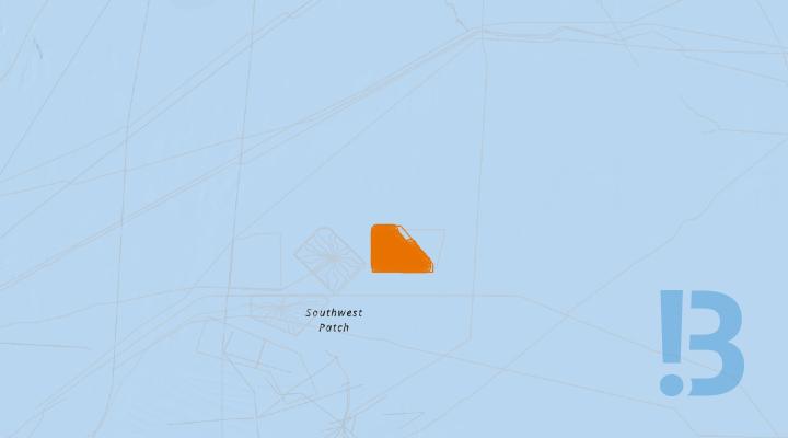
Offshore Construction - Dogger Bank C Offshore Wind Farm
Offshore Construction of the Dogger Bank C Offshore Wind Farm commenced on the 5th of October 2024. The development of the windfarm is made up of several elements - current ongoing elements are described below in the 'full notice' and in the attached file. This notice will be updated weekly, giving information on the progress and resources involved in the offshore project.
Construction Support Activities
Inter-Array Cable Installation OperationsThe Service Operations Vessels (SOVs) Norside Cygnus and Wind Evolution will continue inter-array cable installation and construction support operations.
See detailed map on our bulletin website

Eastern Green Link 3 - Marine Geophysical Survey
Mariners are advised that a marine geophysical survey is planned by NKT, the Principal Contractor, for the Eastern Green Link 3 (EGL 3) project.
The marine survey activities for EGL 3 are planned to commence around 27th November 2026 in Sandford Bay, and are expected to complete around 18th of December 2026, subject to weather. The survey equipment will consist of towed or pole mounted MBES, SSS, SBP, USBL, and Mag. SSEN Transmission and National Grid Electricity Transmission (NGET) are working together to address the need for increased capacity within the transmission network between Scotland and England. EGL3 will help provide increased capacity, carrying up to 2 GW of electricity, enough for two million homes. This will be achieved through a High Voltage Direct Current (HVDC) cable connection between Aberdeenshire and Lincolnshire. The EGL 3 marine geophysical survey works are being carried out by Fugro Limited. The area of work, pertaining to this Notice to Mariners (NtM) for EGL 3, is highlighted in Figure 1, with the survey vessels contact details for the project found in Table 1. Contact details for the project Fisheries Liaison Officers are detailed below.
See detailed map on our bulletin website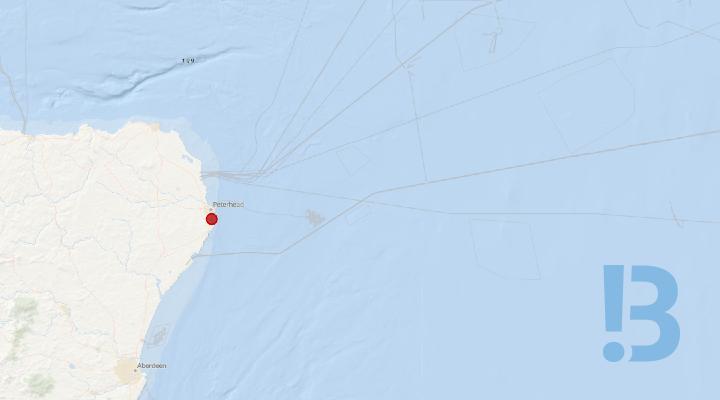
Eastern Green Link 2 - Peterhead HDD Exit Pit Retention
An exit pit has previously been excavated as part of HDD operations associated with the Eastern Green Link 2 (EGL2) project. Retention of pit for around 18 months associated with HDD operations. There is to be no anchoring within the vicinity of the exit pit.
The exit pit contains two duct ends which have been capped, and the pit has been backfilled with rock bags and previously excavated material from the seabed (to avoid snagging issue). The project will return in 2028 to expose the duct ends and allow pull-in of cables through the ducts.
There are expected to be no vessels attending the retained exit pit. Any future activity associated with the pit/EGL2 operations in the area will be subject to future notices.
Mariners should be aware of the localised reduction in water depth associated with the remaining seabed berms and exercise appropriate caution when navigating in the vicinity of the exit pit.
See detailed map on our bulletin website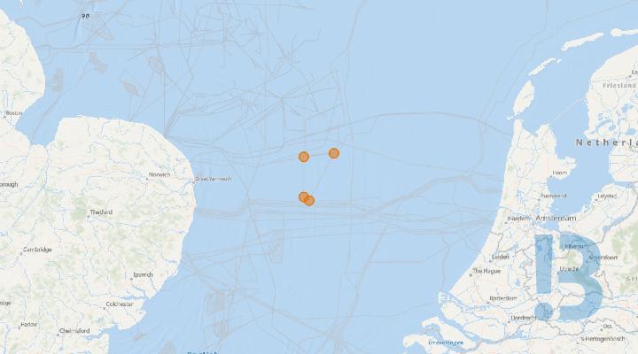
CTV NR Predator - East Anglia THREE Offshore Windfarm
Please be advised that the crew transfer vessel NR Predator is expected to mobilise from the port of Lowestoft
Crew Transfer Vessel NR Predator will provide assistance during the construction phase of the East Anglia THREE Offshore Windfarm Array and will make regular transits between East Anglia THREE CDM and the ports of Lowestoft and Great Yarmouth.
Outer Thames Estuary Special Protection Area (SPA):
As required under Deemed Marine License Condition 13(1)(c)(v) to minimise disturbance to red throated diver in the Outer Thames Estuary Special Protection Area (SPA) during construction of East Anglia THREE, these areas shall as far as practicable be avoided during transits from 01st November to 31st March.
See detailed map on our bulletin website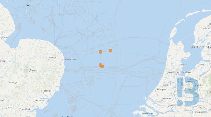
East Anglia THREE site - Bos Prelude (OFCS Platform Supply Vessel)
Please be advised that the platform supply vessel ‘BOS PRELUDE’ is expected to mobilise from the port of Emden circa the 02/11/2025. Earliest arrival at East Anglia THREE site circa the 04/11/2025.
The platform supply vessel ‘BOS PRELUDE’ provides supply service during the commissioning phase of the East Anglia THREE Offshore Converter station (OFCS) ‘EA3 OFCS’.
‘BOS PRELUDE’ will deliver supplies to the ‘EA3 OFCS’ and the jack-up vessel ‘JB 120’ (as long as installed next to the OFCS) as well as carry out regular voyages between East Anglia THREE Windfarm and the ports of Emden (Germany, main service port) and Lowestoft (UK) and is equipped with VHF multi-channel radios and mobile phones.
See detailed map on our bulletin website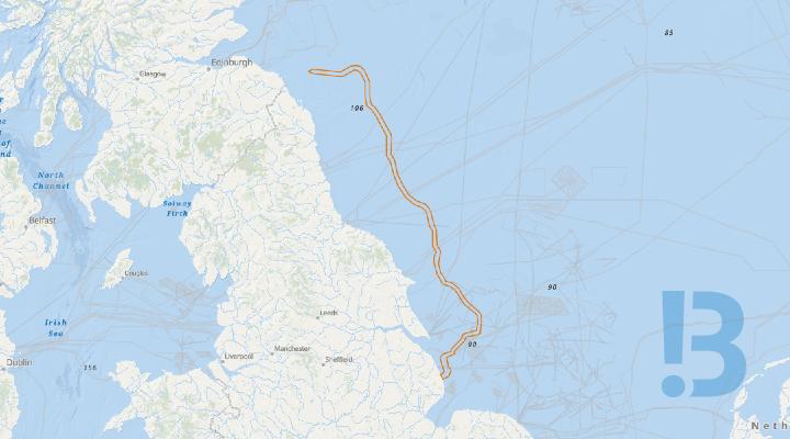
Eastern Green Link 4 - UXO and Marine Archaeology Survey (Geophysical)
Mariners are advised that UXO (Unexploded Ordnance) and Archaeology marine geophysical surveys are planned for the Eastern Green Link 4 (EGL4) project. The marine survey activities for EGL 4 are planned to commence on the 1st July 2026 at the south of the route in English offshore waters near Lincolnshire, working northwards, and are expected to complete in November in English offshore waters at the English-Scottish border (before continuing into Scottish waters to Fife, shared in separate NtM).
NtM Update 11/09/26: Additional offshore survey vessel: Ocean Geograph - See Table 1 below. Additional Scout/Guard Vessel: GV Ability – See Table 2 below.
The survey equipment will consist of: Multibeam echosounder, side-scan sonar, USBL (ultra-short baseline acoustic positioning system), magnetometer array, and eBOSS (KP45-55 only).
Scottish Power Transmission (SPT) and National Grid Electricity Transmission (NGET) are working together to address the need for increased capacity within the transmission network between Scotland and England. EGL4 will help provide increased capacity, carrying up to 2 GW of electricity, enough for two million homes. This will be achieved through a High Voltage Direct Current (HVDC) cable connection between Fife and Lincolnshire.
The EGL 4 UXO marine survey works are being carried out by Gardline Ltd.
See detailed map on our bulletin website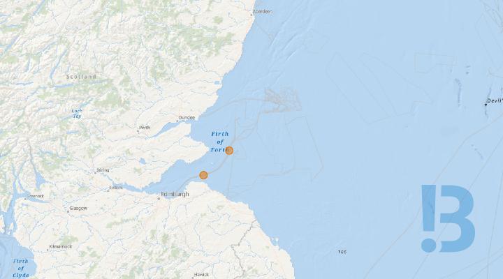
Inch Cape Export Cable 2 Joint Burial & Nearshore Cable Mattress Installation
All mariners and stakeholders are advised that export cable 2 joint burial and nearshore cable mattress installation activities will commence.
On behalf of Inch Cape Offshore Ltd, Enshore Ltd shall commence nearshore cable mattress installation and export cable 2 joint burial activities.
The utility vessel Voe Vanguard will arrive at the nearshore area to commence mattress installation on or around the 22nd of October to commence operations as shown below in fig 1. On completion the vessel will proceed to the export cable joint locations to commence burial operations as shown below in fig 2. The Inch Cape Export Cable corridor is shown in fig 3. Vessel detail shown in section 4.
During mattress installation an autonomous vessel shall be utilised to survey the nearshore area.
The Uni-Mini UAV is a small 1.7m vessel used for survey in areas of shallow water. The UAV will be launched and controlled from Prestonpans beach, the vessel detail is shown below in section 4.
See detailed map on our bulletin website

Inter Array Cable Rock Bag Installation - East Anglia THREE Offshore Windfarm
Mariners are advised that Seaway 7 will undertake Rock Bag Installation operations along the Inter Array Cable Route within the East Anglia THREE Offshore Windfarm area set out in section 2.1 of this document, utilising the vessel ‘Ocean Marlin’.
Activity Description:
Rock Bag installation will be performed along the Inter Array Cable strings, within the East Anglia THREE Offshore Windfarm area set out in section
Program Schedule:The Ocean Marlin is expected to mobilise from the port of Lowestoft circa 27th June 2026 with an estimated completion date of 30th July 2026, weather permitting.
Completion of the works will be notified through the cancellation of this Notice to Mariners. Weekly updates on vessel movements will be issued via the EA3 Weekly Notice of Operations.
Ocean Marlin will monitor VHF Channel 16 and VHF DSC Channel 70 continuously throughout the operations. It is currently anticipated that weather permitting, works will be carried out on a continuous basis (i.e.,24- hour working, seven days a week) unless notified otherwise
See detailed map on our bulletin website
Eastern Green Link 3 - Anderby Creek Geophysical Survey
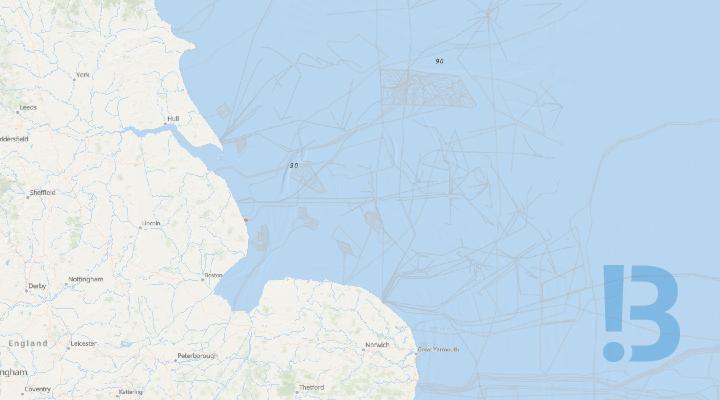
Mariners are advised that a marine geophysical survey is planned by NKT, the Principal Contractor, for the Eastern Green Link 3 (EGL 3) project. The marine survey activities for EGL 3 are planned to commence around 14th November 2026 at Anderby Creek, and are expected to complete around 30th of November 2026, subject to weather. The survey equipment will consist of towed or pole mounted MBES, SSS, SBP, USBL, and Mag.
SSEN Transmission and National Grid Electricity Transmission (NGET) are working together to address the need for increased capacity within the transmission network between Scotland and England. EGL3 will help provide increased capacity, carrying up to 2 GW of electricity, enough for two million homes. This will be achieved through a High Voltage Direct Current (HVDC) cable connection between Aberdeenshire and Lincolnshire.
The EGL 3 marine geophysical survey works are being carried out by Fugro Limited.
The area of work, pertaining to this Notice to Mariners (NtM) for EGL 3, is highlighted in Figure 1, with the survey vessels contact details for the project found in Tables 1 & 2. Contact details for the project Fisheries Liaison Officers are detailed below.
See detailed map on our bulletin website
Inch Cape Met Mast Navigational Lighting and Fog Signal Maintenance
All mariners and stakeholders are advised that maintenance works on the Inch Cape Met Mast are now complete, the mast navigation lights and fog signals are fully operational.
All mariners and stakeholders are advised that maintenance works on the Inch Cape Met Mast are now complete, the mast navigation lights and fog signals are fully operational.
See detailed map on our bulletin website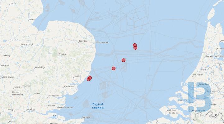
East Anglia THREE Offshore Windfarm - Confirmed Unexploded Ordnance
Please be advised that confirmed Unexploded Ordnance has been identified at the following locations. All vessels are advised to navigate with caution and keep clear of highlighted positions by a 300m radius. Please see attached notice to mariners for further information regarding exclusion zones.
Confirmed Unexploded Ordnance within the East Anglia Three CDM boundaries of the offshore windfarm array and export cable route.
See detailed map on our bulletin website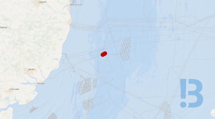
East Anglia THREE Export Cable Corridor - Fishing Exclusion Zone
Mariners are advised that following the rock installation campaigns in 2026, there are some areas in need of further investigation and protection within the East Anglia THREE Export Cable Corridor as detailed in section 2 of this NtM.
Fishers are requested not to fish in the exclusion zone detailed in section 2 of this document until further notice, or the withdrawal of this NtM. Fishing gear and/or other seabed intervention equipment should not be deployed within the exclusions zone.
Vessels are requested not to interact with the seabed in the exclusions zone detailed in section 2 of this document until further notice.
See detailed map on our bulletin website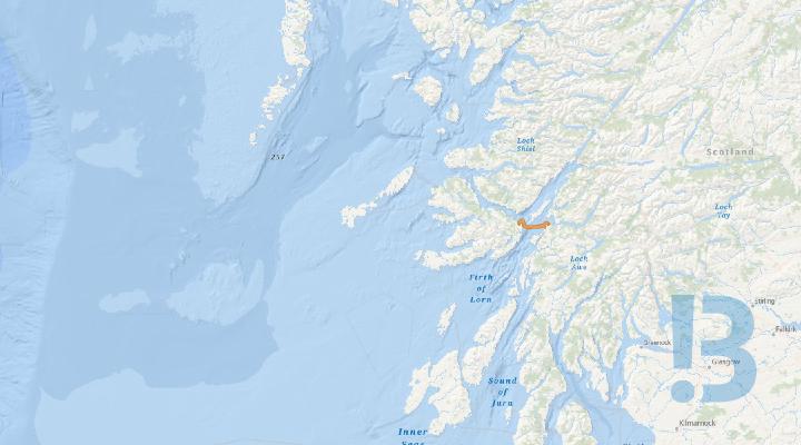
SHEPD Mainland to Mull - Subsea Cable Route Survey
XOCEAN is planning the collection of geophysical data using remotely piloted Uncrewed Surface Vessels (USVs) along a proposed cable route corridor from the Scottish Mainland to the Isle of Mull.
XOCEAN USVs and Support Vessel are shown in the attached notice, along with contact information for the vessels, as well as the Fisheries Liaison Team. The USVs are expected to operate out of Oban for the full survey duration. The survey will commence with USVs with hull mounted survey Multibeam Echosounders and Sub Bottom Profiler’s (SBP), as well as a towed Sidescan Sonar (SSS) and Magnetometer. A crewed Support Vessel will be chartered throughout the survey to support the USVs with departures and arrivals from Ardentallen and assist in towing them back in if a technical issue occurs.
See detailed map on our bulletin website
Berwick Bank - Geophysical Survey
Mariners are advised that Berwick Bank Wind Farm Limited (BBWFL) will be returning to the Berwick Bank Wind Farm Area to undertake further geophysical survey work.
Updated (23/10/2026) – Amended Start Date. The geophysical survey vessel will arrive on site from 27 October 2026.
Update (19/10/2026) - updated to include support vessel details.
Overview
The survey will focus upon the southern half of the wind farm area, with an additional survey in the north of the wind farm area. As towed equipment will be deployed, BBWFL are engaging with static gear fishers and have advised of specific areas in which gear should be cleared. A support vessel will be present to work alongside the survey vessel. An offshore fisheries liaison officer (OFLO) will be on the survey vessel.
The survey work is being undertaken by TGS and will be conducted by the Ramform Vanguard vessel.
Survey Duration
The survey is anticipated to take approximately 2 weeks. To account for all eventualities including weather delays, we would like to extend the duration of notice validity to 30 November 2026.
For further information, please refer to the full Notice to Mariners document contained within the PDF Attachment.
See detailed map on our bulletin website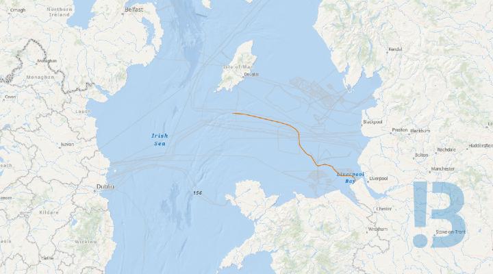
Western HVDC Link - Geophysical Survey Operations
Survey work is being carried out along part of the Western HVDC Link cable route to the south and west of the Isle of Man by the XOCEAN Uncrewed Survey Vessels (USV), X-08 Uncrewed and X-16 Uncrewed. The work is started in October 2026 and is due to be completed by the end of November 2026.
XOCEAN will undertake a geophysical inspection survey of approximately 127km of the Western Link HVDC cable system from the south of the Isle of Man to its landfall at the Wirral, England.
The survey will be completed using an XOCEAN Uncrewed Surface Vessel (USV) equipped with Multibeam Echo Sounder (MBES) and towed Side Scan Sonar (SSS) systems.
The objective of the survey is to monitor cable burial status, seabed mobility, rock berms, concrete mattresses, cable crossings and associated seabed features identified during previous inspection campaigns
The location of the survey work is illustrated in a map in the Notice to Mariners, along with details of the USV and support vessel.
See detailed map on our bulletin website
Vanguard West Offshore Wind Farm - Installation of Boundary Demarcation Buoyage
Mariners are advised that circa. 11th November 2026 until further notice, the Multi Purpose Vessels “FCS Vega”, "BB Ocean" and “TSM Bergen” shall be installing the boundary demarcation buoyage at the Vanguard West Offshore Wind Farm. On or about 6th November 2026 until further notice, the Guard Vessel (GV) “Jason 2” shall be supporting the infield monitoring of the Vanguard West Offshore Wind Farm, including the upcoming demarcation buoyage boundary installation.
Mariners are requested to refrain from entering and transiting through the construction area as demarcated by these demarcation buoys.
Note: The demarcation installation vessels may not all be on site at the same time, but all are expected to be active with buoyage installation works at some stage through the notified campaign.
Vessels will maintain a listening watch on VHF Channel 16 and will actively transmit an AIS signal. Vessels will comply with the International Rules for the Prevention of Collisions at Sea (COLREGS) at all times.
| Vessel Name | Vessel Type | Callsign | MMSI | IMO | Length | Telephone Number | Email Address |
| Jason 2 | Guard Vessel | MJFY4 | 232036020 | 8827404 | 22m | +31 (0) 255 760008 |
jason@dbconnect.nl |
| FCS Vega | Multi Purpose Vessel | LEZI | 257011630 | 9267273 | 45m | +47 412 15 482 |
vega@fcs.as |
| TSM Bergen | Multi Purpose Vessel | FNZU | 228484700 | 1092581 | 39m | +33 6 74 05 33 92 |
bergen@tsmgroup.eu |
| BB Ocean | Anchor Handling Vessel | LFBI | 258825000 | 9196503 | 57.9m | +47 90188588 |
bbocean@bube.no |
The table below provides a summary of each Cardinal and Special Mark Buoy deployed at the VGW array, including target coordinates in WGS84 Degrees Decimal Minutes and a description of llight and top mark specifications.
| Buoy Type | I.D. | Latitude (DDM) | Longitude (DDM) | Light and Top Mark Specifications |
| North Cardinal Buoy | N1 | 52° 56.939′ N | 002° 19.891′ E | North cardinal shaped top mark, exhibiting a Quick (Q) light character. |
| North Cardinal Buoy | N2 | 52° 59.716′ N | 002° 26.494′ E | North cardinal shaped top mark, exhibiting a Quick (Q) light character. |
| North Cardinal Buoy | N3 | 53° 02.493′ N | 002° 33.104′ E | North cardinal shaped top mark, exhibiting a Quick (Q) light character. |
| East Cardinal Buoy | E1 | 53° 00.015′ N | 002° 34.670′ E | East cardinal shaped top mark, exhibiting a Q (3) 10s light character. |
| East Cardinal Buoy | E2 | 52° 54.996′ N | 002° 34.700′ E | East cardinal shaped top mark, exhibiting a Q (3) 10s light character. |
| East Cardinal Buoy | E3 | 52° 49.976′ N | 002° 34.731′ E | East cardinal shaped top mark, exhibiting a Q (3) 10s light character. |
| South Cardinal Buoy | S1 | 52° 48.295′ N | 002° 32.343′ E | South cardinal shaped top mark, exhibiting a Q (6) + L Fl 15s light character. |
| South Cardinal Buoy | S2 | 52° 47.704′ N | 002° 26.643′ E | South cardinal shaped top mark, exhibiting a Q (6) + L Fl 15s light character. |
| West Cardinal Buoy | W1 | 52° 52.160′ N | 002° 22.039′ E | West cardinal shaped top mark, exhibiting a V Q (9) 10s light character. |
| West Cardinal Buoy | W2 | 52° 55.833′ N | 002° 18.998′ E | West cardinal shaped top mark, exhibiting a V Q (9) 10s light character. |
| Special Mark Buoy | SM1 | 52° 58.328′ N | 002° 23.192′ E | Yellow ‘x’ shaped top mark, exhibiting a Fl Y 5s light character. |
| Special Mark Buoy | SM2 | 53° 01.104′ N | 002° 29.798′ E | Yellow ‘x’ shaped top mark, exhibiting a Fl Y 5s light character. |
| Special Mark Buoy | SM3 | 52° 57.505′ N | 002° 34.685′ E | Yellow ‘x’ shaped top mark, exhibiting a Fl Y 5s light character. |
| Special Mark Buoy | SM4 | 52° 52.486′ N | 002° 34.716′ E | Yellow ‘x’ shaped top mark, exhibiting a Fl Y 5s light character. |
| Special Mark Buoy | SM5 | 52° 48.000′ N | 002° 29.493′ E | Yellow ‘x’ shaped top mark, exhibiting a Fl Y 5s light character. |
| Special Mark Buoy | SM6 | 52° 49.930′ N | 002° 24.344′ E | Yellow ‘x’ shaped top mark, exhibiting a Fl Y 5s light character. |
| Special Mark Buoy | SM7 | 52° 54.389′ N | 002° 19.733′ E | Yellow ‘x’ shaped top mark, exhibiting a Fl Y 5s light character. |
See detailed map on our bulletin website
London Array Offshore Wind Farm - Geophysical Survey
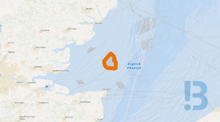
Marine geophysical survey on London Array, commencing 2026-11-09 and expected completion is 2026-12-25. Survey activities will involve the Spectrum 1, with no towed equipment or other craft.
Survey time: 24 hours (preferring day shifts but following tides/ weather)
Vessel contact:
Phone: +44 (0) 7538 565561Email: Spectrum1@spectrum-offshore.com
Survey Project Manager:
Matthew Breedon
Phone: +44 (0) 7942818459
Email: matthew.breedon@spectrum-offshore.com
TETRA Radio. VHF. Wi-Fi.
See detailed map on our bulletin website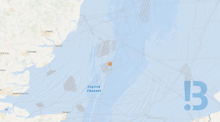
Galloper Offshore Windfarm - WTG Major Component Replacement
Galloper Windfarm will be carrying out a major component exchange from the Jack Up Vessel (JUV) WIND ENERGY in the South Galloper Field on one WTG, GS-D3J.
Galloper Windfarm, RWE - NTM: GWF-O&M 11 -2026 – WTG Major Component Replacement
Please be advised that Galloper Windfarm will be carrying out a major component exchange
from the Jack Up Vessel (JUV) WIND ENERGY in the South Galloper Field on one WTG GS-D3J
Planned Dates: 19th November 2026 for approx. 1 week - subject to weather
An exclusion zone of 500m is required around the JUV
JUV - ZITON WIND ENERGY
Additional Information
· Crew Transfer Vessel Purus Varna supporting from Lowestoft
· Helicopter Operations supporting from Norwich Airport
See detailed map on our bulletin website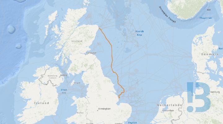
Eastern Green Link 3 Project - UXO and Archaeology Marine Geophysical Survey
Mariners are advised that a UXO and Archaeology marine geophysical survey is planned for the Eastern Green Link 3 (EGL 3) project. The marine survey activities for EGL 3 are planned to commence on the 17th June 2026 in English waters working north and are expected to complete around April 2027 in Scottish waters.
The survey equipment will consist of MBES, SSS, USBL, Mag, ROTV and UXO surrogate testing which will be placed on the seabed a maximum of three times in the nearshore area for equipment verification tests.
SSEN Transmission and National Grid Electricity Transmission (NGET) are working together to address the need for increased capacity within the transmission network between Scotland and England. EGL3 will help provide increased capacity, carrying up to 2 GW of electricity, enough for two million homes. This will be achieved through a High Voltage Direct Current (HVDC) cable connection between Aberdeenshire and Lincolnshire.
The EGL 3 UXO marine survey works are being carried out by GeoXYZ Limited.
The area of work, pertaining to this Notice to Mariners (NtM) for EGL 3, is highlighted in Figure 1, with the survey vessels contact details for the project found in Tables 1 & 2. Contact details for the project Fisheries Liaison Officers are detailed in the attachment.
See detailed map on our bulletin website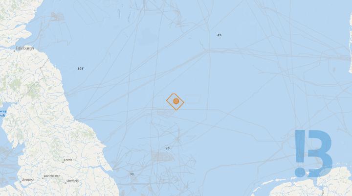
Sofia Offshore Windfarm - Offshore Converter Platform Commissioning Works
Mariners are advised that the Valaris 248 is positioned alongside the Offshore Converter Platform (OCP) supporting the ongoing commissioning programme. The REM Energy is now available to undertake the quarterly maintenance campaign at the Sofia OCP. The SOV 'Austri Enabler' and CTV 'Seazip 9' continued and completed operations within the SOWF Array and are now off hire.
A scheduled service from an assigned pool of Platform Supply Vessels providing supplies to the Offshore Converter Platform & JUV until further notice. Those nominated vessels are:
- Bos Pool;
- Bos Base;
- Dina Merkur;
- Dina Supporter;
- Dina Supplier;
- Dina Scout;
- Highland Knight
An eight legged jacket with 8 driven pin piles has been installed as a foundation for the OCP followed by the OCP itself.
The Sofia Offshore Wind Farm Boundary Co-ordinates where the works will take place are provided below. All non-project vessels are requested to remain outside this area.
Emergency Response & Rescue Vessel
The EERV Glomar Baltic is supporting the commissioning phase of the Offshore Converter Platform, providing close standby cover as required during overside works.
Service Operation Vessels
The Service Operations Vessel (SOV) 'Acta Gemini' continues operations within the Sofia Array.
SOVs shall be transiting to / from the Sofia Array and the port of Blyth / Sunderland throughout this period.
All Mariners are advised to always give a wide berth of approx. 500m metres from the above vessels. The vessels shall have restricted manoeuvrabilitybe exhibiting the correct day signals / night lights for the operations as defined by COLREGS and can be contacted on VHF 16 for further information as required reference proximity / nearby operations etc.
See detailed map on our bulletin website
Sofia Offshore Wind Farm - Demarcation / Met-Ocean Buoys
All Mariners are advised that circa. middle of November 2026 until further notice, there is the potential arrival of the “Kingdom of Fife” and FCS Vega to remove the installed demarcation buoyage at the Sofia Offshore Wind Farm Array.
Vessels shall be monitoring channel VHF 16 and shall be displaying the relevant day shapes / night lights when restricted in its ability to manoeuvre.
Mariners are requested to refrain from entering and transiting through the construction area as demarcated by these demarcation buoys.
The table below provides a summary of each Cardinal and Special Mark Buoy deployed at the SOWF array, including target coordinates in WGS84 Degrees Decimal Minutes and a description of top mark and lantern characteristics. The Demarcation Buoys will be deployed for a period of approximately three years.
| Buoy | ID | Latitude | Longitude | Lantern Characteristics | Lantern Colour |
| North Cardinal | N1 | 55° 08.133’ N | 002° 09.518' E |
VQ 0.5s |
White |
| North Cardinal | N2 | 55° 08.436’ N | 002° 13.418’ E |
Q 1s |
White |
| East Cardinal | E1 | 55° 06.480’ N | 002° 16.929’ E |
Q(3) 10s |
White |
| East Cardinal | E2 | 55° 02.571’ N | 002° 23.925' E |
VQ(3) 5s |
White |
| East Cardinal | E3 | 54° 59.043’ N | 002° 30.269’ E |
Q(3) 10s |
White |
| East Cardinal | E4 | 54° 55.085’ N | 002° 26.631’ E |
VQ(3) 5s |
White |
| East Cardinal | E5 | 54° 51.523’ N | 002° 20.709' E |
Q(3) 10s |
White |
| South Cardinal | S1 | 54° 49.725’ N | 002° 16.726' E |
Q(6) + LFL 15s |
White |
| West Cardinal | W1 | 54° 51.829’ N | 002° 12.194' E |
Q(9) 15s |
White |
| West Cardinal | W2 | 54° 56.229’ N | 002° 03.867' E |
VQ(9) 10s |
White |
| West Cardinal | W3 | 55° 00.623’ N | 001° 56.196' E |
Q(9) 15s |
White |
| West Cardinal | W4 | 55° 04.648’ N | 002° 02.498' E |
VQ(9) 10s |
White |
| Special Mark | SP1 | 55° 02.741’ N | 001° 59.265' E |
FI Y 5s |
Yellow |
| Special Mark | SP2 | 55° 06.569’ N | 002° 05.756' E |
FI Y 5s |
Yellow |
| Special Mark | SP3 | 55° 04.525’ N | 002° 20.428' E |
FI Y 5s |
Yellow |
| Special Mark | SP4 | 55° 00.617’ N | 002° 27.418' E |
FI Y 5s |
Yellow |
| Special Mark | SP5 | 54° 56.871’ N | 002° 29.602' E |
FI Y 5s |
Yellow |
| Special Mark | SP6 | 54° 53.324’ N | 002° 23.621' E |
FI Y 5s |
Yellow |
| Special Mark | SP7 | 54° 54.030’ N | 002° 08.026' E |
FI Y 5s |
Yellow |
| Special Mark | SP8 | 54° 58.427’ N | 001° 59.703' E |
FI Y 5s |
Yellow |
Note: One Seabed Met-Ocean Buoy Mooring (array south) remains in place (Excluding Buoy) and is yet to be recovered. This location is to be avoided by at least 200m.
The table below provides detail of the Seabed Met-Ocean Buoy Mooring that remain in place at SOWF (Excluding Buoy).
| Site Location | Buoy Position | Latitude | Longitude | Note: |
| SOWF | Array South | 54° 55.064' N | 002° 14.632' E | To avoid location by at least 200m |
See detailed map on our bulletin website
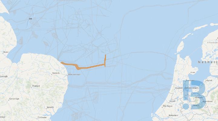
Vanguard West Offshore Wind Farm - Out of Service Cable Removal
The MS Trym continues with Out of Service Cable Removal Works at the Vanguard Offshore Wind Farm export cable route.
Works involve towed equipment between a length of 100m and 250m behind the vessel and this will restrict the vessel’s ability to manoeuvre. It is requested that all vessels operating nearby maintain a safe distance (at least 500m) and pass at minimum speed. All fishing activity should remain outside of the export cable corridor boundaries until further notice.
The vessel will maintain a listening watch on VHF Channels 12 and 16 and will actively transmit an AIS signal. The vessel will comply with the International Rules for the Prevention of Collisions at Sea (COLREGS) at all times. Displaying the prescribed shapes and lights when the vessel is restricted in its ability to manoeuvre.
See detailed map on our bulletin website
Sofia Offshore Wind Farm - Navigation Warning - Unlit Buoyage (E3)
Mariners are advised that the East Cardinal Buoy at the Sofia OWF remains until. Recovery of the buoy is planned circa. late November 2026.
| Buoy | ID | Lat (DDM) | Long (DDM) | Light and Mark Specifications |
| East Cardinal | E3 | 54 59.04N | 002 30.27E |
|
See detailed map on our bulletin website

SHEPD Mainland to Mull - ADCP Survey
Partrac Ltd., on behalf of XOCEAN and Scottish Hydro Electric Power Distribution plc (SHEPD), is deploying a metocean seabed frame monitoring system along a proposed cable route corridor from the Scottish Mainland to the Isle of Mull.
Partrac is planning to carry out the frame deployment within week commencing 2nd November 2026 over one day, weather permitting, using the multicat vessel Tom Scruby. Details of the deployment position are provided in the attached notice. The frame is being deployed for 35 days and will then be recovered. During activities, the vessel will be restricted in their ability to manoeuvre and will display the appropriate lights and shapes prescribed by the International Regulations for Preventing Collisions at Sea. Other vessels are requested to provide a minimum clearance of 50m from the installation vessel during operations, and post-installation, and to pass at a safe speed.
See detailed map on our bulletin website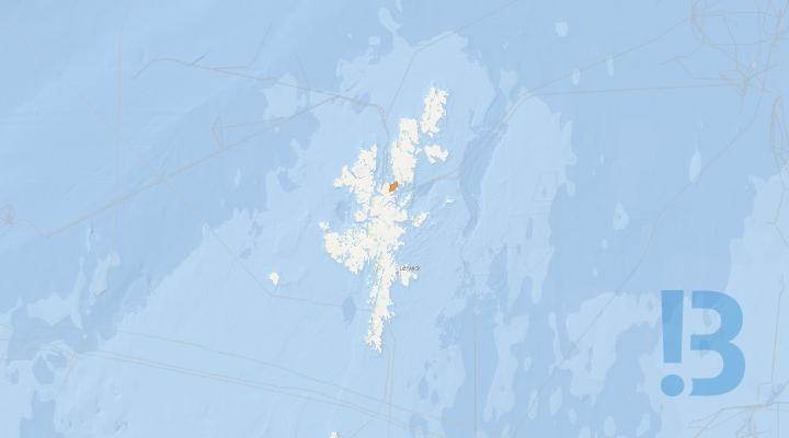
Yell Sound LT216 - Cable Route Survey
Mariners are advised that marine survey activities will recommence for the proposed Yell HVAC LT216 subsea cable. The works will include geotechnical and benthic surveys.
SSEN Transmission conducts marine surveys to obtain information on seabed morphology, installation design and sediment structure, and to support benthic characterisation and habitat mapping. The survey will be conducted by Reach Subsea UK Ltd on behalf of SSEN Transmission. Survey activities are scheduled to recommence within Yell Sound on 16th October 2026, with all outstanding survey works expected to be completed by 30th November 2026, subject to weather and operational conditions.
See detailed map on our bulletin website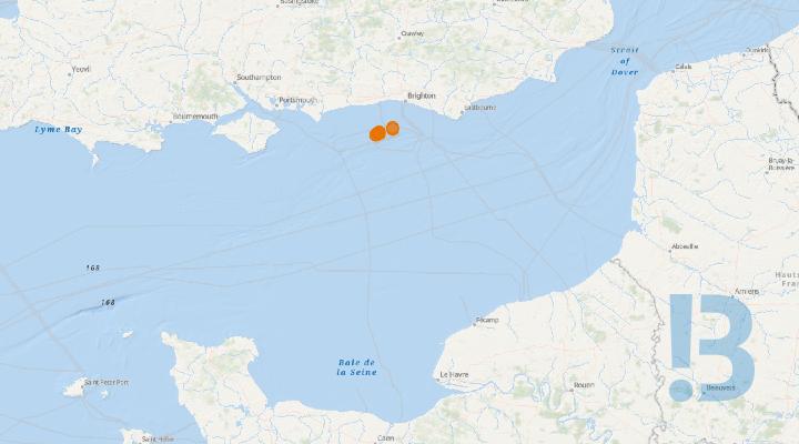
Rampion Offshore Wind Farm- Reef Enhancement for Scour Protection (RESP) Ecological Survey
As part of the Reef Enhancement for Scour Protection (RESP) project, ARC marine will be conducting post installation surveys at 7 turbine locations within the windfarm. The surveys are expected to require four successful days at sea which were originally scheduled for completion by the 2nd November 2026. However, due to unsuitable weather conditions, the survey window has been extended until the 1st December. This survey shall be completed aboard the RV Noctiluca, described below.
Scope of works: As part of the Reef Enhancement for Scour Protection (RESP) project, ARC marine will be conducting post installation surveys at 7 turbine locations within the windfarm. The surveys are expected to require four successful days at sea which were originally scheduled for completion by the 2nd November 2026. However, due to unsuitable weather conditions, the survey window has been extended until the 1st December. This survey shall be completed aboard the RV Noctiluca, described below. Sediment Grab sampling A maximum of 48 sediment grabs shall be collected at the 7 sampling locations (Figure 1) within Rampion OWF. See Appendix A for coordinates. Fishing gear It is kindly requested that any fishing gear is removed from the sampling locations to ensure efficient sampling and minimise impact to operations of all stakeholders in the area. Once works are completed, a follow-up NTM shall be issued to restart normal operations. Safe distance It is kindly requested that all non-survey operations maintain a safe distance of at least 300 meters from all survey turbine locations until the survey concludes (Appendix A), as communicated through proper channels. This is to ensure that all assets and marine users are safe and able to complete the necessary works.
See detailed map on our bulletin website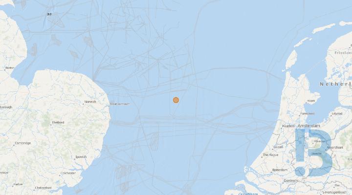
East Anglia THREE Windfarm - OFCS Jack up Barge – JUB Joro
Mariners are advised that circa between 19/10/2026 and 25/10/2026, Jack-up Barge (JUB) ‘Joro’ will commence jacking up next to the East Anglia THREE Offshore Converter Station (OFCS) within the East Anglia THREE Windfarm area set out in section 2. of this document. During the Installation period, vessels are requested to keep a 2000m safety distance at all times from the JUB ‘Joro’ and supporting tugs.
The jack-up vessel ‘Joro’ will be positioned next to the East Anglia THREE OFCS within the East Anglia THREE Offshore Windfarm area.• Rig move: The vessel will be maneuvered to its designated location.• Jacking-Up Procedure: The vessel will be temporarily soft jacked on a safe stand-off position, from where its four anchors and mooring lines will be deployed. The deployed mooring lines will be used to move the vessel safely towards the final position, where the vessel will be jacked.• Operational Phase: Once jacked up, the vessel will remain stationary for an estimated six months. During operations, the ‘Joro’, ‘Horizon Arctic (Anchor Handling tug/Lead tug), ‘Camperdown’ (Assistant tug) and ‘Waterland’ (Assistant tug) will be restricted in their ability to manoeuvre as defined under COLREGs (International Regulations for Preventing Collisions at Sea 1972) and will display the appropriate day shapes and lights. The vessels will also transmit an Automatic Identification System (AIS) message. A Statutory Safety zone of 500m radius will be in place around the JUB Joro at all times. ‘Joro’ and supporting tug are supplied with VHF multi-channel radios and mobile phones.Program Schedule:The ‘Joro’ is has left Port of Ardersier on 20/10/2026 and is currently standby waiting for weather at Winchell Sea II. The towage to East Anglia THREE area is expected to continue between 04/11/2026 and 10/11/2026. Works are subject to weather conditions.The progress of installation works, and completion will be notified via East Anglia THREE Weekly Notice of Operations. Completion of works will be notified by future Notice to Mariners.All vessels will monitor VHF Channel 16 and VHF DSC Channel 70 continuously throughout the operation.It is currently anticipated that weather permitting, works will be carried out on a continuous basis (i.e.,24- hour working, seven days a week) unless notified otherwise.
See detailed map on our bulletin website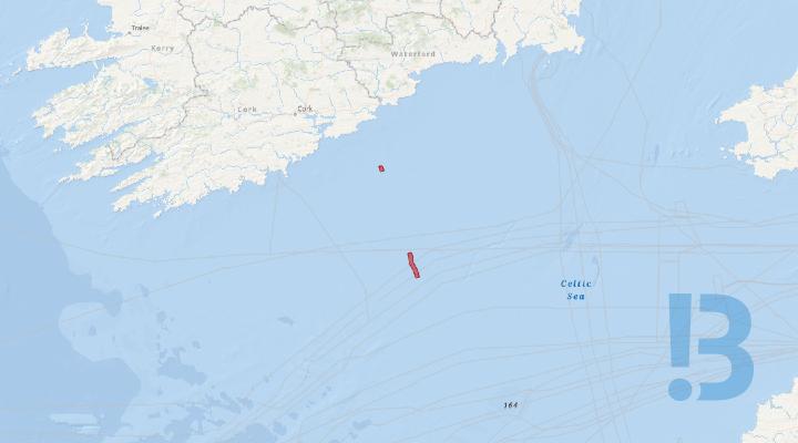
Celtic Interconnector - Cable Activities
The operations in this Marine Notice reflects an update to the activities associated with Marine Notice No. 47 of 2025 (Amended 07/05/2026), in relation to cable lay activities and Support Vessels on the Celtic Interconnector project. Please see the below update to the Celtic Interconnector project and marine operational works in Irish waters.
The current phase of cable burial and protection works in Irish waters is complete for 2026. As a result, the majority of the route is now being re-opened to fishing activities. However, two defined offshore areas will remain temporarily closed until the cable burial and protection is complete, currently expected in 2027.
The two defined areas that will continue to remain temporarily closed to fishing activities are shown with the below coordinates. The two areas include a temporary closure of +/- 1000m either side of cable route. All other areas are re-opened to fishing activities.
Guard vessels
- Two guard vessels remain on site along the temporary closed areas in Irish waters.
- A third guard vessel is available to provide additional support if operationally required.
- The guard vessels will continue to provide daily safety broadcasts and further operational information to passing vessels.
- The vessels will keep a listening watch on channel 16 and transmit an AIS signal
The updated guard vessel (GV) list is shown below:
- GV Lapwing
- GV Star of Hope
- GV Accord (standby)
The position of the vessels will be subject to rotation of the vessels and associated locations.
As part of the marine operational works in Irish waters, subsea rock installation has been used to protect sections of the cable route. Further information on the locations of the subsea rock installation along the route will be made available soon.
There are no further operations planned in Irish waters this year for the Celtic Interconnector project, further information on 2027 operations will provided as they become available.
See detailed map on our bulletin website
Gwynt y Môr Offshore Wind Farm - MBES Survey 2 locations
Notice is hereby given that from the 11th November for 1 day (subject to weather), Spectrum Offshore will be conducting survey operations at 2 WTG locations within the Gwynt y Môr Offshore Wind Farm
Show More
IFA2000 - USV Environmental Survey
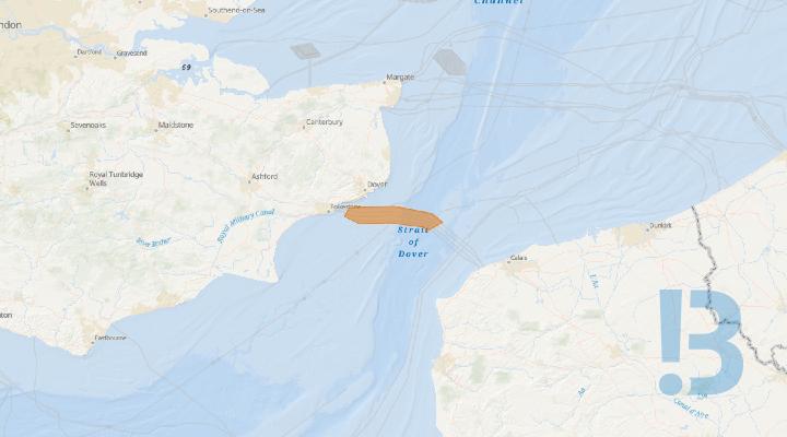
Please be advised that on behalf of National Grid Ventures, Fugro is planning to conduct a geophysical survey in the North Sea from the nearshore limit of the IFA2000 cable south of Dover, (51° 05.1’N 001° 14.2’ W) and extending west offshore to the French border (51° 03.1N 001° 35.9E). The work will be conducted by the un-manned survey vessel (USV), Blue Eclipse, operated from a remote operations centre in Aberdeen.
Seabed video and photography data will be acquired using the eROV mounted camera system deployed from the USV Blue Eclipse.
The survey works shall provide seabed imagery along 43 selected 100m transects along the route illustrated in figure 1.1
As the Blue Eclipse will be station keeping with an ROV deployed, the vessel will be restricted in its ability to manoeuvre.
All vessels operating within this area are requested to keep their distance, maintaining at least the 500m safety zone around the survey vessel, and pass at minimum speed to reduce vessel wash.
A continuous listening watch will be conducted on VHF Channel 16.
See detailed map on our bulletin website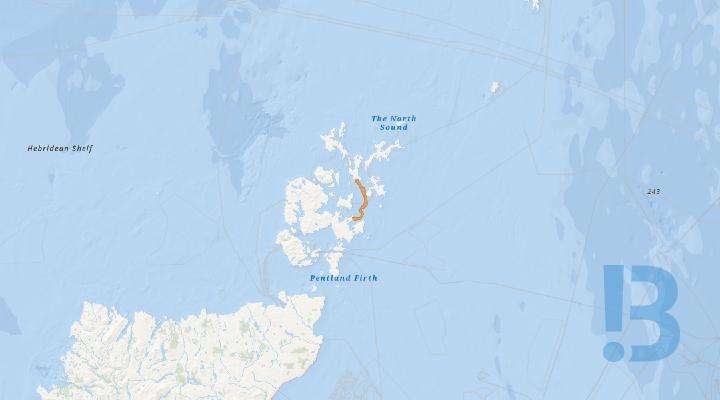
Eday HVAC Subsea Cable - Marine Geotechnical and Benthic Seabed Survey
UPDATE: Additional vessel and updated survey dates have been added SSEN Transmission plan to commence the marine survey on the 06/11/2026 however the earliest start date maybe 31/10/2026. The survey will consist of Benthic grabs, Vibrocores, Core Penetration Tests and Drop Down Camera. The survey equipment will also require calibration testing, which may be conducted outwith the survey corridor.
The survey works are being carried out by Reach Subsea UK Ltd. They are expected to be complete all survey works by end of November 2026, weather dependent. The area of work, pertaining to this Notice to Mariners (NtM) for Eday HVAC Subsea Cable, is highlighted in Figure 1, with survey area coordinates contained in Table 1. The survey vessel contact details for the project found in Tables 2 & 3. Contact details for the project Fisheries Liaison Team (FLO) are also detailed below.
See detailed map on our bulletin website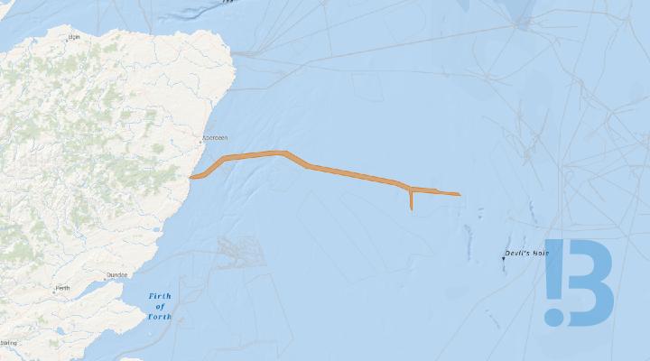
Bellrock Offshore Wind Farm - Geophysical Survey and Benthic Survey
Bellrock Offshore Wind Farm Limited, are continuing a geophysical survey within a potential offshore cable export corridor associated the Bellrock Offshore Wind Farm.
The Geophysical Survey will be undertaken within the area shown on Figure 1, and Figure 2a to 2f and Table 1 contained within the NtM document attachment. Multiple vessels will be utilised during the Geophysical Survey:
§ One geophysical survey vessel;
§ Up to four unmanned surface vessels (USV) carrying geophysical survey equipment; and
§ One support vessel.
Details of the vessels being used for the Geophysical Survey are provided in Table 2 below.
The Geophysical Survey vessel and USVs will be utilising hull-mounted and towed geophysical survey equipment which requires manoeuvring space. A non-geophysical support vessel for the USVs will also be utilised. The survey campaign is expected to take approximately 60 days to complete (between 9 August 2026 and 30 November 2026), subject to weather and operational constraints. Although the USVs are uncrewed, they are remotely piloted throughout their 24-hour operation, sending real time images and situational awareness data over satellite for monitoring.
The Benthic Survey will be undertaken within the area shown on Figure 1, and Figure 2a to 2f and Table 1 contained within the NtM document attached. A single vessel will be utilised during the Benthic Survey:
The Benthic Survey will involve drop-down camera imagery and benthic grab sampling, and will be undertaken at each sampling location. Sampling locations will be distributed along the offshore export cable corridor shown in Figure 1 at approximately 1.5 km intervals. Around 130 sampling locations will be targeted.
The Benthic Survey will work around fishing gear, fishing vessel operators will not be requested to remove gear.
The Benthic Survey is expected to take approximately 25 days to complete (between 16 September 2026 and 30 November 2026), subject to weather and operational constraints.
See detailed map on our bulletin website
Western Link 2 - 2026 Survey Campaign
The marine survey activities for WL2 commenced on the 13/07/2026 between the Firth of Clyde, Scotland and Caernarfon Bay, Wales. GEOxyz and Causeway Geotech will be completing offshore and nearshore geotechnical surveys respectively. Ocean Ecology will be undertaking benthic survey work in the survey corridor. Fugro will be undertaking offshore and nearshore geophysical survey work in the survey corridor.
The marine survey activities for Western Link 2 will commence on the 13/07/2026 and includes geotechnical, benthic, and geophysical survey work in the survey corridor, from the Firth of Clyde at the northern end, through the North Channel, into the Irish Sea, and landing at Caernarfon Bay at the southern end.
This notice supersedes the earlier Notice to Mariners dated 23/09/2026 and includes an update toSurvey vessels and support vessels details (Table 1) and Survey vessels’ contact information(Table 3).
The offshore geotechnical work will be undertaken by survey vessel Geo Ocean VI and the nearshore geotechnical work will be undertaken by the jack-up barge Causeway Giant 1. The work will consist of a geotechnical survey to collect high-quality geotechnical data through seabed cone penetration and vibrocoring, and nearshore ground investigation work at borehole locations.
The benthic survey work will be undertaken by the survey vessel, Seren Las, and will consist ofdrop-down camera and grab sampling. Targeted operations will occur in Caernarfon Bay and theIrish Sea.
The geophysical survey work will be undertaken by the Fugro survey vessels Frontier and Seeker.
There will be two landfalls in Ayrshire, Scotland, and one landfall in Caernarfon Bay, Wales.
See detailed map on our bulletin website
London Array - Export Cable Survey
Survey work consists of Multibeam Echo Sounder (MBES) and towed Sidescan Sonar (SSS) bathymetric surveys in 4 separate sections along the London Array export cable route
Mariners are advised that RS-Geo, on behalf of Diamond Transmission will be undertaking survey workalong the London Array export cable. This survey requirements plays a critical role in ensuring the ongoingmaintenance and integrity of UK energy infrastructure. Mariners are advised to always maintain a safedistance of at least 500m from the survey vessel location.
Vessel Argyll Explorer will be used for this survey and will be working on 12-hour basis from Ramsgate. The vessel will display the appropriate day shapes and lights and will transmit an AutomaticIdentification System (AIS) message and navigate in accordance with COLREG (International Regulationsfor Preventing Collisions at Sea, 1972).
See detailed map on our bulletin website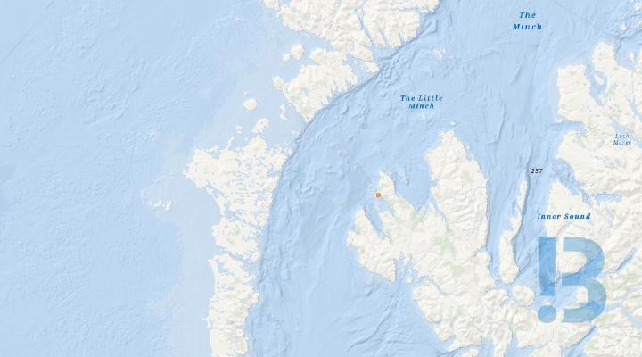
Skye-Uist - Survey and Subsea Cable Installation
Please be advised that Jan De Nul Luxembourg S.A. has undertaken power cable installation and power cable protection activities for the Skye-Uist Replacement project from the 5th June 2026. Cable recovery and subsequent pull-in activities at Ardmore Bay will be undertaken.
Scottish Hydro Electric Power Distribution (SHEPD)
PH003762 Skye-Uist Replacement
Notice to Mariners
Please be advised that Jan De Nul Luxembourg S.A. has undertaken power cable installation and power cable protection activities for the Skye-Uist Replacement project. The project comprises two new subsea power cables: one between Loch Pooltiel on the Isle of Skye and Loch Carnan on the Isle of South Uist and the other one between Ardmore on Isle of Skye and Loch Pooltiel on Isle of Skye.
This notice supersedes the earlier Notice to Mariners dated 20/10/2026. The cable installation described in the previous Notice have now been completed, except for protection works to the cable end at Ardmore Bay, Isle of Skye.
The cable end at Ardmore Bay was successfully recovered and the pull-in of the cable towards the landfall is now complete. The remaining activities comprise dive works in support of cable protection operations. Mariners are requested to maintain a safe distance from the vessel and associated equipment and to give the vessel a wide berth where practicable.
See detailed map on our bulletin website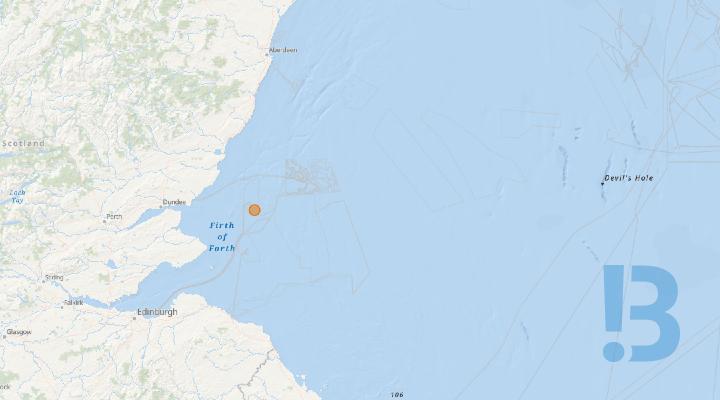
Inch Cape Wind turbine Generator Installation & Commissioning Activities
All mariners and stakeholders are advised that wind turbine generator installation and commissioning activities shall commence.
All mariners and stakeholders are advised that Vestas Wind Systems A/S shall commence the installation and commissioning of 72 wind turbine generators (WTG’s).
The installation of 72 WTG’s shall be conducted by the construction jack up vessel Wind Mover. The WTG components shall be loaded in the Port of Dundee and transported to the Inch Cape site. Prior to arrival in Dundee for component load out, the Wind Mover shall enter the Inch Cape site and jack up in the safe haven position shown in the attached Notice to Mariners. Wind Mover is expected to arrive at Inch Cape on or around Friday the 30th of October.
WTG commissioning activities shall be conducted from the Service Operations Vessel Acta Hercules. Technicians will access the WTG’s via a walk to work system, operations shall be supported by the crew transfer vessels NOS Exceller and NOS Empowerer, vessel details in the attached Notice to Mariners.
WTG installation and commissioning activities shall continue until September 2027.
See detailed map on our bulletin website
Eastern Green Link 3 Project - UXO and Archaeology Marine Geophysical Survey
Mariners are advised that a UXO and Archaeology marine geophysical survey is planned for the Eastern Green Link 3 (EGL 3) project. The marine survey activities for EGL 3 are planned to commence on the 17th June 2026 in English waters working north and are expected to complete around the end of November 2026 in Scottish waters.
The survey equipment will consist of MBES, SSS, USBL, Mag, ROTV and UXO surrogate testing which will be placed on the seabed a maximum of three times in the nearshore area for equipment verification tests.
SSEN Transmission and National Grid Electricity Transmission (NGET) are working together to address the need for increased capacity within the transmission network between Scotland and England. EGL3 will help provide increased capacity, carrying up to 2 GW of electricity, enough for two million homes. This will be achieved through a High Voltage Direct Current (HVDC) cable connection between Aberdeenshire and Lincolnshire.
The EGL 3 UXO marine survey works are being carried out by GeoXYZ Limited.
The area of work, pertaining to this Notice to Mariners (NtM) for EGL 3, is highlighted in Figure 1, with the survey vessels contact details for the project found in Tables 1 & 2. Contact details for the project Fisheries Liaison Officers are detailed in the attachment.
See detailed map on our bulletin website
NeuConnect C2 & C3 Rock Placement
There will be rock placement works taking place starting 2nd November, in three areas noted below. Dates are subject to weather or operational requirements.
Mariners are advised that post-lay burial cable protection works are due to commence along the NeuConnect UK cable route. Works will be conducted by Prysmian PowerLink and supported by their subcontractors.
Rock placement works are to be continued 2nd November 2026 (below table). Dates are subject to change due to weather or operational requirements.
|
KP Start |
Latitude DMS |
Longitude DMS |
KP End |
Latitude DMS |
Longitude DMS |
|
129.611 |
51°59'54.519"N |
002°10'10.497"E |
129.640 |
51°59'55.377"N |
002°10'11.112"E |
|
130.474 |
52°00'10.563"N |
002°10'45.575"E |
130.486 |
52°00'10.721"N |
002°10'46.150"E |
|
132.623 |
52°00'40.171"N |
002°12'27.446"E |
132.631 |
52°00'12.651"N |
002°10'53.078"E |
Locations and timeframes of all activities, as well as details on guard vessels, are set out in the Notice to Mariners.
See detailed map on our bulletin website
Holm to Burray - Oyster Survey
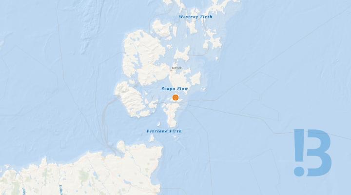
Survey Activities: XOCEAN is planning a dive survey in Echnaloch Bay, Scapa Flow, between 29th October 2026 and 27th November 2026. A mooring will be installed at the mooring positions detailed below. The vessel will transit in/out of Stromness Harbour daily.
Survey Activities: XOCEAN is planning a dive survey in Echnaloch Bay, Scapa Flow, between 29th October 2026 and 27th November 2026. A mooring will be installed at the mooring positions detailed below. The vessel will transit in/out of Stromness Harbour daily.
Dates/Duration: Operations are expected to commence from 29th October 2026. It is expected that the survey activities shall be completed within 2-5 days (subject to weather). With an operational window of 1-2 weeks to account for weather. Legal Notice Please be advised that this Notice to Mariners should be treated as official notice of the nature, duration and location of the works which are scheduled to take place. During the period of this notice, we request that you plan your activities around our short-term, temporary activities. Mariners who believe their operations may be affected by the activities described in this notice are requested to contact the Fishing Liaison Officer or Fishing Industry Representative as detailed at the end of this notice.
Any failure to remove equipment where this has been requested, or entry into the identified location in a manner that would constitute a hazard may be a breach of your duties of safe seamanship as described in the Convention on International Regulations for Preventing Collisions at Sea 1972 and/or the Merchant Shipping Act 1995, and may result in removal of the relevant equipment. Failure to remove equipment, where this has been requested, or entry into the identified location in a manner that would constitute a hazard may constitute a breach of duty of care at common law, and a failure to protect submarine cables for successful seabed user co-existence under Scotland's National Marine Plan.
SHEPD shall found on this notice in the event of any damage, loss or disruption arising from failure to heed the information herein.  Survey Area: Figure 1 below shows the mooring locations (red circles) and a 500m exclusion radius around the diving area. These mooring locations are detailed in Table 1 below and will be marked with two yellow mooring cans with flashing lights. Flashing sequence is 1 flash every 5 seconds.
See detailed map on our bulletin website
Orkney HVAC Hazard
SSEN wish to advise mariners of the completion of activities in relation to the Orkney HVAC, GVI & Mattress lay works.
Mariners are advised of the completion of marine activities in relation to the Orkney HVAC, GVI & Mattress works.
The completion of the works includes the installation of several mattresses at the locations highlighted in the attached NTM. These assets will facilitate cable installation works in early 2027.
As such, until the final cable is installed, these assets pose a hazard to marine users. Mariners are therefore advised to maintain a stand-off of 200m from this asset until further notice.
Contact details for any queries can be found in NTM.
See detailed map on our bulletin website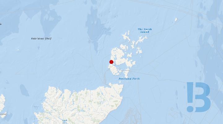
HVAC Link Project - Orkney Caithness
Scottish & Southern Electricity Networks (SSEN) wish to inform Mariners of the completion of marine works in the near-shore area off Warbeth, Orkney which forms part of the Orkney -Caithness HVAC Link Project. As a result two subsea structures are now located on the sea bed and pose a hazard.
Scottish & Southern Electricity Networks (SSEN) wish to inform Mariners of the completion of marine works in the near-shore area off Warbeth, Orkney which forms part of the Orkney -Caithness HVAC Link Project. The completion of this work includes the installation of two subsea assets in the form of two ducts and associated rock bags approx 1km SW of Warbeth Beach, Orkney and have been placed with in the boundaries of the 4 points and associated coordinates detailed in the attached NTM.
Mariners are advised to maintain a stand -off of 200 m from the area until further notice.
See detailed map on our bulletin website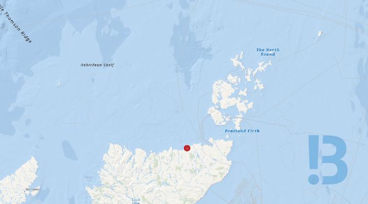
Orkney HVAC Project Dounreay HDD
Scottish & Southern Electricity Networks Transmission (SSENT) wish to advise on the completion of marine activities in relation to the Orkney HVAC, Dounreay HDD works, located in the near-shore area off Dounreay. The completion of the works includes the installation of two subsea HDD ducts and supporting rock bags. These assets will facilitate the cable installation works in early 2027.
Mariners are advised of the completion of marine activities in relation to the Orkney HVAC, Dounreay HDD works, located in the near-shore area off Dounreay.
The completion of the works includes the installation of two subsea HDD ducts and supporting rock bags. These assets will facilitate the cable installation works in early 2027.
As such, until the final cable is installed, these assets pose a hazard to marine users. Mariners are therefore advised to maintain a stand-off of 500m from this asset until further notice. Full details and coordinates are contained in attatched NTM.
See detailed map on our bulletin website
Barrow Offshore Wind Farm - Potential Inter-Array Cable Exposures
Potential inter-array cable exposures between WTGs A03 - A04, OSS - B01 and OSS - C01.
A survey has identified potential cable exposures at several locations beyond the commonplace exposures (within the 50m radius around wind turbine and offshore substation foundations). The position and extent of the cable exposures shown in the below chart is limited to the burial status observed at the time of the survey. Cable burial status evolves over time, often rapidly. Mariners should not assume otherwise. Cable burial status is monitored periodically, and further information will be provided following future survey campaigns. Ørsted advises mariners to maintain care when operating within the windfarm array area.
See detailed map on our bulletin website
Seagreen Offshore Wind Farm – Site Perimeter Navigational Aid Lighting Failures
Site Perimeter Navigational Aid Lighting Failures
Multiple perimeter Wind Turbine Assets around Seagreen Offshore Wind Farm have failures of the Navigational Aids. This has been reported by the NLB after site survey was conducted. Failures include insufficient lighting range, insufficient / incorrect signal characters and reduced Navigation.
See detailed map on our bulletin website
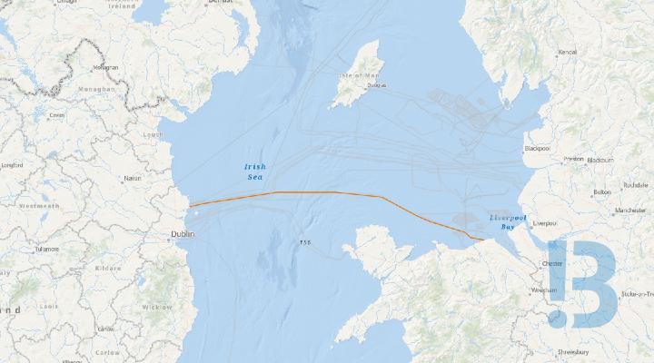
EWIC Geophysical Cable Condition Survey – Ireland and UK
Mariners are advised that geophysical survey operations will be undertaken along the 187km EWIC cable between Ireland and Wales. Survey operations are estimated to take 6 days in total excluding weather. All operations are expected to be completed by 15/11/2026.
The survey will be split into nearshore and offshore areas with Irish nearshore works commencing on or around 22nd October 2026 using the Lady Kathleen, followed by the Welsh nearshore area, likely to commence on or around 27th October 2026. Nearshore Operations will be conducted 12hrs per day.
Offshore operations will commence with the vessel Roman Rebel on or around 01st November 2026, operating 24 hours per day.
Survey operations will consist of geophysical survey works using hull mounted multibeam echosounder and towed sidescan sonar, with optional drop down or ROV mounted camera to follow geophysical operations. Two survey lines are planned, one either side of the existing cable.
The vessels will display appropriate lights and markers and will have restricted manoeuvrability whilst towing equipment. The vessels will be listening on channel 16 throughout the course of the survey.
See detailed map on our bulletin website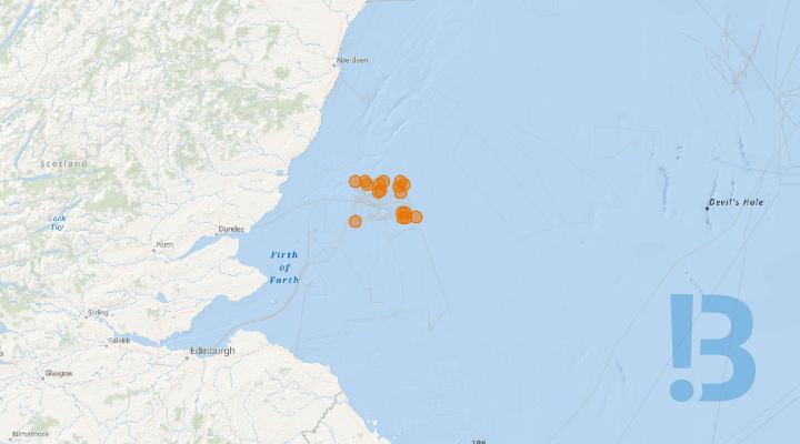
Seagreen Offshore Wind Farm – Uncrewed Surface Vessel (USV) Subsea Inspection Activities of Assets
2 x Unmanned survey vessels (USV) with deployable Remotely Operated Vehicles (ROVs) will be conducting subsea inspection works at Seagreen offshore windfarm. These surveys will include surveys of 39 WTGs, 1 OSS and may inspect certain Inter Array Cable locations. These surveys will be operating 24/7 for the duration of the campaign.
A support vessel will escort the USV from the harbour entrance until open water. The USV will then continue transiting towards the survey site. It is requested that other vessels remain clear, so far as is practicable, during transit & survey operations. Although the vessels are unmanned, it is crewed throughout the 24-hour operation, piloted remotely using 360-degree cameras and other navigational aids
The only means of direct VHF communications with the vessels is on VHF Channel 16 Project vessels are advised to contact Seagreen Marine Control on VHF private channel P1 when entering or traversing within the windfarm.
All mariners are advised to keep a safe clearance distance of no less than 500m from the USVs and inspected Asset.
See detailed map on our bulletin website
Floating LiDAR Validation at NOAH met mast
Venterra has deployed one Floating LiDAR Buoy in the area around the NOAH Met Mast under Marine Licence L/2020/00313/1. This document is to notify mariners regarding the deployment.
Venterra has deployed one Floating LiDAR Buoy in the area around the NOAH Met Mast. Deployment operations will take place using the FCS Vega on or around 30th September 2026, weather permitting. The buoy will remain on station for a minimum of 1 month.
See detailed map on our bulletin website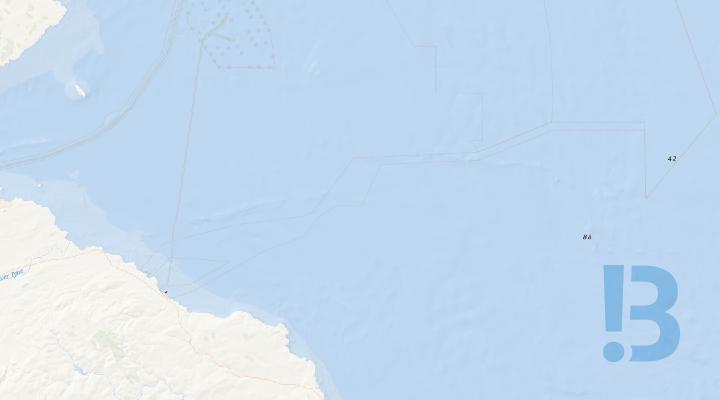
Eastern Green Link 1 - Sediment Accumulation
Sediment berms of up to 2 m remain within the pre-trenched area at the EGL1 Torness landfall. The sediment accumulation will remain in place until cable installation activities commence in 2027.
Fishermen are advised that the Eastern Green Link 1 Project has been undertaking pre-trenching works in the nearshore area adjacent to the cable landfall at Torness in preparation for the future cable installation campaign. Post-survey data indicates that sediment berms of up to 2 m in height remain within the isolated area where the trench was created. This sediment build-up will remain in situ until cable installation activities are undertaken in 2027.
Following cable installation, the accumulated sediment will be utilised to backfill the exposed cable and precut trench. as part of the post-installation seabed reinstatement activities. Fishermen should be aware of the presence of this feature when returning to fish in the area once the current survey works have been completed and the area has been reopened to static gear fishing.
See detailed map on our bulletin website
ED2 Campaign 4 Subsea Inspections - Argyll
Please be advised that Socotec Land & Hydrographic Surveys (on behalf of SHEPD) will be undertaking subsea inspections across the Argyll & Bute Marine area. Please refer to Figure 1 - Figure 5 that highlights each cable location.
Please be advised that Socotec Land & Hydrographic Surveys (on behalf of SHEPD) will be undertaking subsea inspections across the Argyll & Bute Marine area. Please refer to Figure 1 - Figure 5 that highlights each cable location. Given the different conditions and water depths anticipated at each site, a range of vessels will be available for the project, detailed overleaf. The inspection works will be centred on a 50m cable corridor, defined by the start and end coordinates listed in Table 1.
See detailed map on our bulletin website
Orkney - ED2 Campaign 4 Subsea Inspections
Please be advised that Socotec Land & Hydrographic Surveys (on behalf of SHEPD) will be undertaking subsea inspections across the North Coast & Orkney marine areas. Please refer to Figure 1 - Figure 2 that highlights each cable location.
Please be advised that Socotec Land & Hydrographic Surveys (on behalf of SHEPD) will be undertaking subsea inspections across the North Coast & Orkney marine areas. Please refer to Figure 1 - Figure 2 that highlights each cable location. Given the different conditions and water depths anticipated at each site, a range of vessels will be available for the project, detailed overleaf. The inspection works will be centred on a 50m cable corridor, defined by the start and end coordinates listed in Table 1.
See detailed map on our bulletin website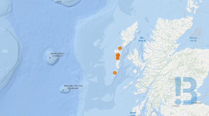
Outer Hebrides - ED2 Campaign 4 Subsea Inspections
Please be advised that Socotec Land & Hydrographic Surveys (on behalf of SHEPD) will be undertaking subsea inspections across the Outer Hebrides marine areas. Please refer to Figure 1 - Figure 7 that highlights each cable location.
Please be advised that Socotec Land & Hydrographic Surveys (on behalf of SHEPD) will be undertaking subsea inspections across the Outer Hebrides marine areas. Please refer to Figure 1 - Figure 7 that highlights each cable location. Given the different conditions and water depths anticipated at each site, a range of vessels will be available for the project, detailed overleaf. The inspection works will be centred on a 50m cable corridor, defined by the start and end coordinates listed in Table 1.
See detailed map on our bulletin website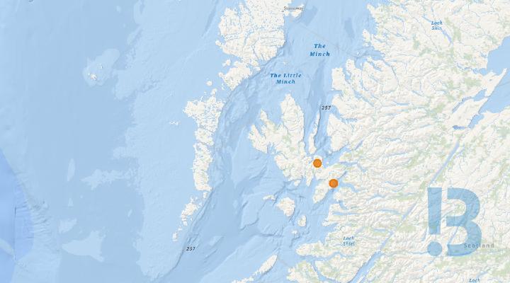
West Highlands - ED2 Campaign 4 Subsea Inspections
Please be advised that Socotec Land & Hydrographic Surveys (on behalf of SHEPD) will be undertaking subsea inspections across the West Highland marine areas. Please refer to Figure 1 - Figure 4 that highlights each cable location.
Please be advised that Socotec Land & Hydrographic Surveys (on behalf of SHEPD) will be undertaking subsea inspections across the West Highland marine areas. Please refer to Figure 1 - Figure 4 that highlights each cable location. Given the different conditions and water depths anticipated at each site, a range of vessels will be available for the project, detailed overleaf. The inspection works will be centred on a 50m cable corridor, defined by the start and end coordinates listed in Table 1.
See detailed map on our bulletin website
SHEPD - Forth Tay & Moray Subsea Inspections
Please be advised that Socotec Land & Hydrographic Surveys (on behalf of SHEPD) will be undertaking subsea inspections across the Forth Tay & Moray Marine areas. Please refer to Figure 1 - Figure 2 that highlights each cable location.
PROJECT OVERVIEW Please be advised that Socotec Land & Hydrographic Surveys (on behalf of SHEPD) will be undertaking subsea inspections across the Forth Tay & Moray Marine areas. Please refer to Figure 1 - Figure 2 that highlights each cable location. Given the different conditions and water depths anticipated at each site, a range of vessels will be available for the project, detailed overleaf. The inspection works will be centred on a 50m cable corridor, defined by the start and end coordinates listed in Table 1.
See detailed map on our bulletin website
Eday HVAC Subsea Cable - Marine Habitat Survey Operations
Mariners are advised that a marine habitat survey is planned for the proposed Eday HVAC Subsea Cable. The survey will involve geophysical and benthic surveying. SSEN Transmission conduct marine surveys to gain information on seabed morphology, installation design, sediment structure and to gain benthic characterisation and habitat mapping.
SSEN Transmission plan to commence the marine survey inside 12nm on the 19th October 2026. The survey equipment will consist of Multi Beam Echo Sounder (MBES), Side Scan Sonar (SSS), Drop Down Camera (DDC) on a vessel. The survey equipment will also require calibration testing, which may be conducted out with the survey corridor. The offshore survey works are being carried out by Triscom Ltd. They are expected to be complete all survey works by end of November. The area of work, pertaining to this Notice to Mariners (NtM) for Eday HVAC Subsea Cable, is highlighted in Figure 1, with survey area coordinates contained in Table 1. The survey vessel contact details for the project found in Tables 2 & 3. Contact details for the project Fisheries Liaison Team (FLO) are also detailed below.
See detailed map on our bulletin website
East Anglia THREE Offshore Windfarm 036 - 2026 - CSOV Norwind Hurricane
Please be advised that the Commissioning Service Operation Vessel (CSOV) ‘Norwind Hurricane’ is expected to mobilise from the port of Lowestoft circa the 08/10/2026. The main working area is within the East Anglia THREE Offshore Windfarm area set out in section 2.1 of this document. All vessels are requested to keep a 500m safety distance from the ‘Norwind Hurricane’ whilst carrying out operations within the East Anglia THREE Offshore Windfarm Array.
The CSOV ‘Norwind Hurricane’ will provide accommodation and Walk-to-Work access for the commissioning phase of the East Anglia THREE Offshore Converter station (OFCS) and WTG Commissioning.
It is currently anticipated that weather permitting, operations will be continuous for a duration of approximately four weeks. Crew change in port is carried out approximately every four weeks. This will be communicated in East Anglia THREE Weekly Notice of Operations. Completion of works will be communicated by closure of this notice.All vessels are required to monitor VHF Channel 16 and VHF DSC Channel 70 continuously throughout the operation.
See detailed map on our bulletin website
Eastern Green Link 1 - ACSM Marine Operations
Mariners are advised regarding upcoming survey activities, boulder clearance and removal of out of service cables within the defined corridor which is being undertaken for the Eastern Green Link 1 Project. This is a HVDC electricity transmission interconnector between England and Scotland, and is a joint venture between National Grid and Scottish Power.
The works, managed by Prysmian, will be carried out between 10th October 2026 and 31st January 2027 (weather dependent). Mariners are advised that these works will be taking place within areas already closed as part of the ongoing Identification and Clearance Works. Vessels, when transiting, are requested to pass at a safe speed and distance of at least 500m from the Works Area. During the ongoing works, the vessel will have restricted manoeuvrability as it completes the work scopes. VHF CH 16 will be monitored at all times and will be used to contact the coastguard in the event of an emergency.
See detailed map on our bulletin website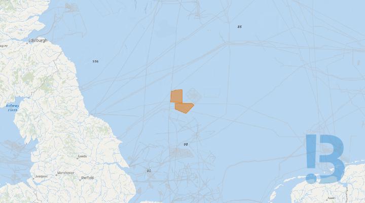
Dogger Bank Windfarm - Geophysical Survey
On behalf of Dogger Bank Offshore Wind Farm, XOCEAN will be carrying out an MBES geophysical survey within Dogger Bank A and Dogger Bank B array area sites, using several remotely piloted Uncrewed Surface Vessels (USVs).
The USVs will be mobilised from Scarborough where each USV will be escorted out of the harbour limits, before transiting to the survey area. Survey Operations will be continuous 24hrs a day. Although vessels are uncrewed, they are managed remotely continuously using 360-degree cameras and other sensors.
The works will commence on the 07/10/2026, continuing until 31/11/2026 when all locations have been surveyed. The works will be continuous, 24 hours a day. A charts of the DBA and DBB Array Area coordinates are provided below
It is requested that all vessels maintain a minimum of 500m separation distance from the USVs and pass at reduced speed.
See detailed map on our bulletin website
East Anglia Three Offshore Wind Farm - Inter Array Cable Installation
Mariners are advised that Grand Canyon III will carry out IAC cable trenching and burial operations within the East Anglia Three Offshore Windfarm Boundary. Rix Lion and HST Poole will assist with crew transfer operations. During Cable laying operations, all vessels are requested to keep a 500m safety distance from the Norside Supporter, Seaway Moxie, Windea Clausius & Grand Canyon III.
Grand Canyon III will conduct trenching and burial operations supporting the cable-laying operation. Duringcable deployment, trenching & burial all vessels involved will be restricted in their ability to manoeuvre.Seaway Moxie, Norside Supporter & Windea Clausius will undertake equipment and personnel transfers toWTGs and the OFCS via a Walk‑to‑Work (W2W) gangway system. While conducting these transfers, theSeaway Moxie, Norside Supporter & Windea Clausius will also be restricted in manoeuvrability.Rix Lion & HST Poole will be the CTV support vessels providing 24hr support covering both cable installationand T&T works.1.3. Program Schedule:Seaway Moxie has mobilised already and are actively operating on the project since January 2026.Windea Clausius and Grand Canyon III have mobilised already and are actively operating on the projectsince February 2026.Norside supporter has mobilised already and is actively operating on the project since August 2026.Rix Lion has mobilised already and is actively carrying out crew transfer operations.HST Poole is expected to mobilise circa 03/10/2026During the cable laying operations, ‘Grand Canyon III’ will have restricted manoeuvrability as defined underCOLREGS (International Regulations for Precenting Collisions at Sea 1972.) They will display theappropriate day shapes and lights and will transmit an Automatic Identification Systems (AIS) message.All project vessels will monitor VHF Channel 16 and VHF DSC Channel 70 continuously throughout theoperation. It is currently anticipated that weather permitting, works will be carried out on a continuous basis(i.e., 24-hour working, seven days a week) unless notified otherwise.Completion of works will be notified by closure of this notice to mariners; weekly updates of vesselmovements will be notified via EA3 weekly notice of operations
See detailed map on our bulletin website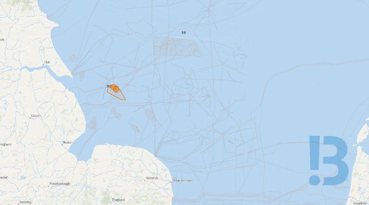
Construction of Wind Farm - Triton Knoll
Activities related to the development of the Triton Knoll wind farm continue, as detailed below. For background information visit: http://www.tritonknoll.co.uk. Mariners are advised that the Jack Up Vessel ‘Deme APOLLO’ will be undertaking WTG main component exchange works at the Triton Knoll Offshore Wind Farm.
The JUV will facilitate all lifting activities and main component exchanges at: A17, U10, M12, G05, Q09.
A 500m clearance to the vessel and all fixed structure locations whilst working in this area is required,
Mariners are advised that the Northern Wind will be conducting a full site survey using high resolution MBES (inc Backscatter). The Cardinal P will be conducting a full site internal survey with the use of ROV. A 500m clearance to the vessel and all fixed structure locations whilst working in the area is required.
The following vessels are operational at the Triton Knoll Offshore Wind Farm (TKOWF) as outlined within previously issued NtM's:
|
Vessel Name |
Type |
Call Sign |
MMSI |
IMO |
Operating Port |
Commence Date |
| Windcat 11 | Crew Transfer Vessel | 2BIS9 | 235066459 | N/A | Grimsby | 14/12/2020 |
| Esvagt Havelok | Service Operations Vessel | OYFR2 | 219026496 | 9878981 | Grimsby | 25/09/2021 |
| Njord Amundsen | Support Vessel | ZDSO3 | 236112802 | 1036355 | Grimsby | 10/05/2024 |
| Windward Athens | Service Operations Vessel | 9HA6380 | 249776000 | 1041687 | Grimsby | 01/06/2026 |
| Apollo | Jack Up Vessel | LXBP | 253586000 | 9769764 | Grimsby | 13/07/2026 |
|
All vessels can be contacted via VHF channel 16 when operational in field. *** Note *** All 90 WTG's have now been fully installed, whilst WTG commissioning and service continues. All Export Cables are fully installed/buried and need to be deemed live/energised. All Inter Array Cables are fully installed and buried and need to be deemed live/energised. Whilst the main installation works have been completed, major construction commissioning works are continuing. *** Note *** Whilst TKOWFL is reopening the site to fishing from the 14th December 2021, TKOWFL kindly request that all fishermen intending to fish within the boundaries of the Triton Knoll wind farm, contact the Triton Knoll control room prior to entering and exiting the field, and inform them of their fishing intentions This precaution is requested to safeguard all vessels operational at the TKOWF site (including fishing vessels) and your cooperation, to ensure the safety of all parties is appreciated. The following contact details should be used when notifying the Triton Knoll control room of fishing activity: Control Room Manager: Lee Wheat Radio: VHF channel 16 Callsign: TK MCC Phone: +44 1793 896250 Email: tkcr@rwe.com *** Note *** Application of Triton Knoll Wind Farm Safety Zones During Construction The Secretary of State has granted the Application of Safety Zones on the Triton Knoll Wind Farm Project as follows:
|
Mariners are advised that all foundations monopiles have been installed and all inter-array and export cables have been installed.
Navigation Warning - 08th January 2021
Mariners are advised that the remnants of a Wave Rider Buoy sinker weight and partial rigging are located within the Triton Knoll Offshore Wind Farm Construction site at the following location;
53° 30.442N 000° 50.564E
It is advised that the partial rigging could potentially be floating up to 9.7m above the seabed, reducing the navigable safe water in the immediate area to 10m LAT. Mariners are advised to avoid the indicated position by 250 metres.
Possible Dangers to Navigation - Properties of the polypropylene show that the rope is buoyant, this makes the line sensitive for thruster currents. Taking the site water depth into consideration (19.7m LAT) and the maximum expected height above seabed of the rope 9.7m the line is expected to be floating submerged at approximately -10m LAT. In addition, it is noted that over time sediments will be trapped between the fibres and the heavier rope may finally sink. The polypropylene rope may impose a risk to foul propellers / propulsion of vessels due to the buoyant nature of the rope. As the rope is submerged at a depth of ~-10m LAT the risk is considered minimum for vessels with a shallow draught (<5m) and medium for a vessel with a deeper draught (>5m). Over time sediments will be trapped between the fibres and the heavier rope may finally sink thereby reducing the risk to propellers/propulsion of vessels. The clump weight itself (chain) is expected to have sunk into the seabed and has no significant height above seabed. In addition, the edges of the clump weight are mostly rounded (chain), the risk the clump weigh imposes to fishing activities/gear is therefore considered to be minimal.
Navigation Warning - 16th March 2021
Mariners are advised that two UXO targets have been confirmed within the Triton Knoll Offshore Wind Farm Array.
Mariners are advised that the two confirmed targets are located within 20 metres water depth (LAT) and a 10 metre radius exclusion zone is required around each target. The following table provides the coordinates and a description for each target.
| Description of Target | Latitude | Longitude |
Water Depth (LAT) Metres |
Required Exclusion Zone (Metres Radius) |
| Archaeological - The item is thought to be an air-delivered bomb. It appears to be in a stable condition and is resting on the seabed. Marine growth and concretion cover the body, indicating it has been in situ for a significant duration. The tail section of the bomb is missing, which is typical of unexploded bombs from WWII found in these circumstances and there is a significant hole in the case. The dimensions and characteristics gathered are consistent with a 500kg German bomb. Considering the state of the bomb the Net Explosive Quantity of the bomb is likely to be <5kg. | 53°31'50.249"N | 00°47'45.908"E | 20 | 10 |
| Archaeological - The item is thought to be an air-delivered bomb. It appears to be in a stable condition and is resting on the seabed. Marine growth and concretion cover the body, indicating it has been in situ for a significant duration. The tail section of the bomb is missing, which is typical of unexploded bombs from WWII found in these circumstances and there is a significant hole in the case. The dimensions and characteristics gathered are consistent with a 500kg German bomb. Considering the state of the bomb the Net Explosive Quantity of the bomb is likely to be <5kg. | 53°31'49.895"N | 00°47'45.115"E | 20 |
10 |
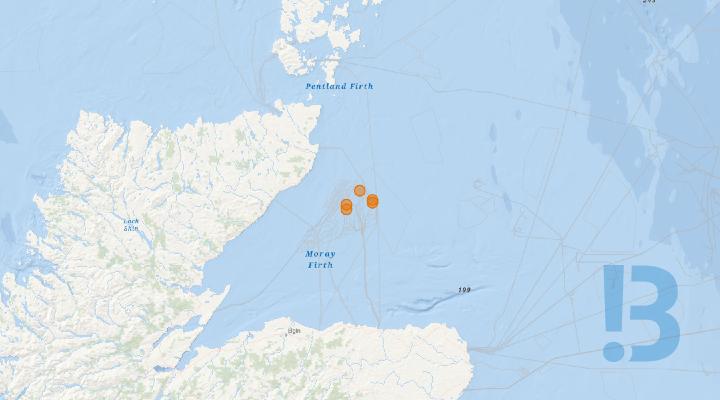
Moray Offshore Windfarm (East) Limited - Major Component Exchange
Please be advised that Moray Offshore Windfarm (East) Limited (Moray East) are planning to commence major component repairs on five Wind Turbine Generators (WTGs) as shown in Table 1 These activities will be undertaken using the Jack-up vessel, Wind Discovery, detailed below. Activities are now expected to take place between 14/10/2026 and 01/12/2026 weather permitting.
Please be advised that Moray Offshore Windfarm (East) Limited (Moray East) are planning to commence major component repairs on five Wind Turbine Generators (WTGs) as shown in Table 1 These activities will be undertaken using the Jack-up vessel, Wind Discovery, detailed below. Activities are now expected to take place between 14/10/2026 and 01/12/2026 weather permitting.
Table 1: WTG location
|
WTG |
DD MM.ddd |
|
|
Latitude |
Longitude |
|
|
L09 |
58° 11.826' N |
2° 48.962' W |
|
C15 |
58° 13.043' N |
2° 48.954' W |
|
K16 |
58° 13.550' N |
2° 36.307' W |
|
K17 |
58° 14.189' N |
2° 36.133' W |
|
G21 |
58° 16.644' N |
2° 42.604' W |
Table 2: Vessel Information
|
Wind Discovery |
|
|
Call Sign: |
OUHH2 |
|
MMSI: |
219034268 |
|
Offshore Contact: |
Email: Master.winddiscovery@ziton.eu Tel : +45 4888 0697 |
|
|
|
Please be aware that, during the major repair activities, by virtue of its mode of operation the Jack-up vessel will be Restricted in her Ability to Manoeuvre (RAM) as defined under COLREGs (International Regulations for Preventing Collisions at Sea 1972, Rule 3). Masters of vessels are therefore requested to maintain their vessels and gears at a minimum safe passing distance from the vessel of 500 metres when it is undertaking work and showing the appropriate shapes and lights in accordance with COLREGs Rule 27.
In order to not compromise the safety of the Wind Discovery and their crew, and the ability to undertake its contracted works, fishermen who have static fishing gears deployed within 500 m from the WTG where major repairs are planned (see Table 1) are requested to provide the coordinates of such deployed gears in DMS and details of whether the surface markers used are visible at all states of visibility to Alex Winrow-Griffin (Brown & May Marine) using the contact information below (Section 58 of the Merchant Shipping Act 1995).
Fishermen who have static gears deployed beyond 12 nm are reminded that static gear must be marked in accordance with Commission Implementing Regulation (EU) No. 404/2011 (https://www.gov.uk/guidance/marking-of-fishing-gear-retrieval-and-notification-of-lostgear#marking-of-fishing-gear).
The Scottish Ministers have authorised the establishment of a 500-metre radius safety zone around all major maintenance works being undertaken. The safety zones will be active when the jack-up vessel involved in undertaking major maintenance works is attached to, or anchored next to, the renewable energy installation. No more than one 500 metre major maintenance safety zone will be active at any given time.
All mariners are requested to give a wide berth to all vessels involved in the major repair activities.
Mariners are requested to navigate with caution, to use all means appropriate to aid safe navigation as defined under COLREGs Rule 7, and keep continued watch on VHF Ch. 16, 87 and 73 when navigating the area.
1. Contact details
The following contact can provide more information if required. Please note that specific queries can also be addressed to the relevant vessel or shore-based representative.
|
Contact Details |
|
|
Marine Coordination Centre 24/7 Email mcc@morayeast.com Duty MC 24Hrs Tel : +44 7884630427 |
For fisheries related matters Alex Winrow-Giffin – Brown and May Marine Ltd Email: alex@brownmay.com Tel : +44 1379 872148 / +44 7760 160039 |
See detailed map on our bulletin website

Gwynt y Môr Offshore Wind Farm - JUV Operations - Irish Sea
Notice is hereby given that from the 9th October for up to 7 weeks (subject to weather and other factors), Ziton A/s and MPI will be conducting maintenance operations including heavy lift operations at 13 locations within the Gwynt y Môr Offshore Wind Farm
Show More

Debris following Collision - Unmanned Survey Vessel
Unmanned survey vessel debris following collision. Planning is underway to recover this.
Re-surveyed March 26
See detailed map on our bulletin website
Greater Gabbard windfarm - UXO
A UXO was found and is currently sitting in position 51'57.924'N 001'56.122'E as per NTM. This is inside the Greater Gabbard windfarm - we have no plans to remove/ move/ detonate. This has been surveyed and the risk of detonation is low however we would advise a 500m exclusion zone Re surveyed 03/26
Show More

Metocean Survey - North Falls Offshore Wind Farm
Overview Mariners are advised that North Falls Offshore Wind Farm (NFOWF) are undertaking a metocean survey within the Wind Turbine Array Area, at the Primary and Secondary locations shown in Table 1 and Figure 2.
North Falls Offshore Wind Farm - Notice to Mariners. Issue Date 24/09/2026 (Third issue).
Overview
Mariners are advised that North Falls Offshore Wind Farm (NFOWF) are undertaking a metocean survey within the Wind Turbine Array Area, at the Primary and Secondary locations shown in Table 1 and Figure 2.
Survey Duration The metocean equipment was deployed on 17 April 2026, with the metocean survey lasting between 12 and 18 months. The planned survey end date will be no later than 16 August 2027.
Survey Tasks (Service Visit No. 2)
The metocean survey work is being undertaken by Partrac, who will use the vessel Tom Scruby to recover, service and re-deploy the metocean equipment at the Primary and Secondary locations shown in Table 1 and Figure 2.
It is expected that the recovery, servicing and re-deployment operations will last for approximately five days, commencing on or after 29 September 2026.
The metocean equipment consists of one seabed frame deployed at each location (i.e., a total of two seabed frames). Each seabed frame will be equipped with an acoustic Doppler current profiler (ADCP) and additional sensors (temperature sensor, water-level sensor, and turbidity sensor). Each seabed frame will be connected to a clump weight, with approximately 100 m leaded polypropylene ground line between the seabed frame and clump weight.
The metocean equipment is not marked with surface buoys. As a consequence of equipment being serviced, all mariners are advised to keep a safe clearance distance of no less than 500 m from the service vessel and metocean equipment deployment locations. No towed survey equipment will be deployed from the vessel.
See detailed map on our bulletin website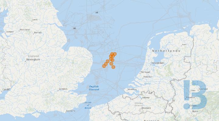
East Anglia Three Offshore Windfarm - Marine Mammal Monitoring-Passive Acoustic Monitoring Stations
Please be advised that Seiche Limited have performed a service on the Passive Acoustic Monitoring (PAM) Stations that have been deployed on the seabed, in and at locations around the East Anglia THREE Offshore Windfarm Area. Two PAM stations have been re-deployed with surface buoys
A service has been completed on the Passive Acoustic Monitoring (PAM) Stations that have been deployed on the seabed, in and at locations around the East Anglia THREE Offshore Windfarm Area. A total of eleven PAM stations have been re-deployed, two of which are marked by surface buoys.
The PAM stations will remain on the seabed until approximately 31/10/2027, 9 deployed PAM stations have a 12 m height above the seabed, a weight of 600 kg and their location is not marked by a surface buoy. Two deployed PAM stations are marked by surface buoys, each anchored to the seabed by two 2 tonne anchor mooring weights.
The PAM stations will be serviced periodically with information distributed via future Notice to Mariners. There is an exclusion zone of 250m around each PAM Station, Marine traffic is advised to maintain the safety zone and navigate with caution at all times.
See detailed map on our bulletin website
Construction Support Activities - Inch Cape
All mariners and stakeholders are advised that Inch Cape shall continue construction support activities.
All mariners and stakeholders are advised that Inch Cape shall continue construction support activities.
On completion of transition piece foundation completion work scopes this week, Siem Barracuda will remobilise for jacket foundation pin pile soil plug removal works.
em Barracuda is expected to commence soil plug removal on or around the 23rd of September, the works will continue for several weeks, vessel detail below.
See detailed map on our bulletin website
St Andrews Bay & Inverbervie - Passive Acoustic Monitor Array
All mariners and stakeholders are advised that a Passive Acoustic Monitoring (PAM) mooring array for the purpose of monitoring marine mammals’ detections is currently deployed along the east coast of Scotland, within 2 km of the coast, between St Andrews Bay and Inverbervie.
All mariners and stakeholders are advised that a Passive Acoustic Monitoring (PAM) mooring array for the purpose of monitoring marine mammals’ detections is currently deployed along the east coast of Scotland, within 2 km of the coast, between St Andrews Bay and Inverbervie.The PAM array will remain in situ for 2 years (i.e. up to August 2027) with a service interval every 3 months. The moorings will not be surface marked as the top of the mooring extends approximately 4-7m above the seabed. A servicing campaign was completed on 11 September.
A separate mooring assembly remains in place at St Andrews Bay with a temporary surface marker buoy. This was deemed as a dropped object in previous NTM, as the marker buoy could no longer be located. This has been now confirmed to remain in place, to be recovered in the following days.
See detailed map on our bulletin website
Inch Cape Offshore Wind Farm - Acoustic Monitor Array Deployment
All mariners and stakeholders are advised that a Passive Acoustic Monitoring (PAM) mooring array for the purpose of monitoring marine mammals’ detections has been serviced and redeployed along the east coast of Scotland, within 2 km of the coast, between St Andrews Bay and Inverbervie.
All mariners and stakeholders are advised that a Passive Acoustic Monitoring (PAM) mooring array for the purpose of monitoring marine mammals’ detections is currently deployed along the east coast of Scotland, within 2 km of the coast, between St Andrews Bay and Inverbervie.
The PAM array will remain in situ for 2 years (i.e. up to August 2027) with a service interval every 3 months. The moorings will not be surface marked as the top of the mooring extends approximately 4-7m above the seabed. A servicing campaign was completed on 11 September.
A separate mooring assembly remains in place at St Andrews Bay with a temporary surface marker buoy. This was deemed as a dropped object in previous NTM, as the marker buoy could no longer be located. This has been now confirmed to remain in place, to be recovered in the following days.
|
No |
Location |
Lat |
Lon |
Water depth (m) |
Status |
|
P1 |
St Andrews bay |
56° 23.664' N |
002° 38.599' W |
19.6m |
Deployed |
|
St Andrews bay  (with temporary surface marker buoy) |
56°23.632 N |
002°38.655 W |
|
Deployed |
|
|
P2 |
Broughty ferry |
56° 25.912' N |
002° 38.441' W |
16.6m |
Deployed |
|
P3 |
Carnoustie |
56° 28.955' N |
002° 38.060' W |
15.8m |
Deployed |
|
P4 |
Arbroath |
56° 34.009' N |
002° 30.256' W |
21.7m |
Deployed |
|
P5 |
Montrose |
56° 41.619' N |
002° 25.153' W |
22.9m |
Deployed |
|
P6 |
Inverbervie |
56° 49.882’ N |
002° 15.268’ W |
22.9m |
Deployed |
See detailed map on our bulletin website

Offshore Wind Vanguard East (VGE) - Confirmed UXOs
Mariners are advised that ten confirmed Unexploded Ordnance (UXO) have been identified within the Norfolk Vanguard East project areas.
Five locations are identified within the Norfolk Vanguard East array site and five identified within the export cable route. Those locations are presented below.
All vessels are advised to navigate with caution and keep clear of the provided positions by a 300m radius.
See detailed map on our bulletin website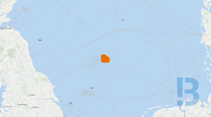
Dogger Bank C Offshore Wind Farm - Scour Protection Installation
Fall Pipe Vessel (FPV) Daniel Bernoulli will supply, transport, and install scour protection at various locations on DBC
Daniel Bernoulli will start operations on 30th of Auhust 2026 and will perform rock placement during multiple loadouts, finishing her scope around 10th of October 2026. Work will be continuous, 24 hours a day.
During operations, Daniel Bernoulli will be restricted in their ability to manoeuvre, as defined under COLREGs (International Regulations for Preventing Collisions at Sea 1972) and will display the appropriate day shapes and lights. The vessel will also transmit an Automatic Identification System (AIS) message.
It is requested that all vessels maintain a minimum of 500m separation distance from the Flintstone and pass at reduced speed.
See detailed map on our bulletin website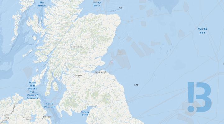
Neart na Gaoithe - Exposed IA cable on seabed
A section of the Orange D Cable is exposed and Mariners are advised to avoid this area for safety, until this can be rectified.
Mariners are advised that Neart na Gaoithe Offshore Wind Farm Limited (NnGOWL) has completed the replacement and burial of the Orange-D inter-array cable (IAC). However, a short section of the Orange-D IAC remains below target burial depth and is identified as a seabed hazard.
Mariners are requested to avoid the area defined by the coordinates provided in Table 1.
Table 1 – Coordinates for the seabed hazard - exposed IAC (Orange-D)
|
|
LONGITUDE (WGS84) |
LATITUDE (WGS84) |
|
|
Seabed Hazard – Exposed inter-array cable
|
2° 15.51′ W |
56° 17.844′ N |
|
|
2° 13.90′ W |
56° 19.064′ N |
||
|
2° 13.56′ W |
56° 18.751′ N |
||
|
2° 14.95′ W |
56° 17.485′ N |
See detailed map on our bulletin website

Debris / Object Moved from Original Position
Following the completion of the EGL2 Bridlington Nearshore Archaeological Dive Works, SSENT and NGET are advising Mariners that a historic wooden windlass, believed to be associated with a historic vessel or maritime structure, has been identified as a moved object on the seabed at the recorded survey position.
Mariners, particularly those operating small craft or deploying anchors, fishing gear, or other seabed contactequipment, are advised to exercise caution in the vicinity of the identified location due to thepotential snagging and anchoring risk and should avoid anchoring directly over the affected area.
See detailed map on our bulletin website
Emergency Response and Rescue Vessels - East Anglia THREE Offshore Windfarm Array
Mariners are advised that Emergency Response and Rescue Vessel (ERRV) ‘VOS Traveller’ is expected to mobilise from the port of Lowestoft circa 05/08/2026. A relief Emergency Response and Rescue Vessel (ERRV) ‘VOS Guardian’ will cover the primary ERRV as and when required. All vessels are requested to keep a 500m safety distance from the ‘VOS Traveller’ and ‘VOS Guardian’ whilst carrying out operations within the East Anglia THREE Offshore Windfarm Array.
Activity Description:‘VOSTraveller’ will provide standby emergency response and rescue within the boundary of the East AngliaTHREE Offshore Windfarm Array. The ‘VOS Guardian’ will be the relief vessel to cover these duties when theprimary emergency response and rescue vessel ‘VOS Traveller’ conducts port calls for crew changes andresupplies.1.3. Program Schedule:All vessels will continuously monitor VHF Channel 16 and VHF DSC Channel 70 throughout operations.It is currently anticipated that weather permitting, works will be carried out on a continuous 24-hour basis,seven days a week, unless notified otherwise.Arrival and departure plan of the VOS Traveller & VOS Guardian will be notified via the East Anglia THREEWeekly Notice of Operations.Completion of the vessels work scope will be notified by closure of this Notice to Mariners
See detailed map on our bulletin website
Eastern Green Link 1 - Nearshore Works
Mariners are advised about pre-trenching and Horizontal Directional Drilling (HDD) exit pit excavation works at the EGL1 corridor being undertaken for Eastern Green link 1 which is an HVDC electricity transmission interconnector between England and Scotland, a joint venture between National Grid and Scottish Power.
The works, managed by Prysmian are expected to start on or around the 8th August 2026 and are expected to complete on or around the 30th December 2026 (weather dependent).
The first phase of the works will include exit pit and trench excavation, which is expected to take place between 8th August to 15th October 2026. The works will be carried out by Capall Mara (barge) and Manannan (crew transfer vessel).
Following this, HDD marine assistance works will be expected to take place between 15th September and 30th December 2026. This Notice to Mariners will be updated to include the vessels working on the next phase of work.
Vessels, when transiting, are requested to pass at a safe speed and distance, and fishing vessels are advised to remain at a safe distance of at least 1km from the Works Area. Works will be ongoing and the vessels will have restricted maneuverability as they complete their work scopes.
The Communication between the vessels will be through CH67 & 72.
VHF CH 16 will be monitored at all times and will be used to contact the coastguard in the event of an emergency.
See detailed map on our bulletin website
CTV NOS Exceeder - East Anglia THREE Offshore Windfarm Array
Please be advised that the crew transfer vessel NOS Exceeder is expected to mobilise from the port of Lowestoft circa 01/08/2026.
Crew Transfer Vessel NOS Exceeder will provide assistance during the construction phase of the East Anglia THREE Offshore Windfarm Array and will make regular transits between East Anglia THREE CDM and the ports of Lowestoft and Great Yarmouth.
NOS Exceeder is expected to mobilise from the port of Lowestoft circa 01/08/2026.
Completion of the works will be notified through the cancellation of this Notice to Mariners. Weekly updates on vessel movements will be issued via the EA3 Weekly Notice of Operations
See detailed map on our bulletin website
Generation Cables Installation Campaign - Hornsea 3 Offshore Windfarm
Generation Cables Installation Campaign - Hornsea 3 Offshore Windfarm
Show More

Transmission Cables Installation Campaign - Hornsea 3 Offshore Windfarm
Transmission Cables Installation Campaign - Hornsea 3 Offshore Windfarm
Show More

Demarcation Buoys Deployment - Hornsea 3 Offshore Windfarm
Demarcation Buoys Deployment - Hornsea 3 Offshore Windfarm
Show More
Foundation Installation Campaign - Hornsea 3 Offshore Windfarm
Foundation Installation Campaign - Hornsea 3 Offshore Windfarm
Show More

SubSea Soundscape Project - Celtic Sea
17 x scientific seabed passive acoustic monitoring systems with sensor strings in the lower 5m of the water column have been redeployed across the UK Celtic Sea area following serving (4 x full systems from the original array could not be found). Units are fully subsurface with no surface markers. Mariners should exercise caution during operations and avoid trawling or seabed gear deployment near positions. Mariners are advised to exercise caution in the vicinity during active operations.
Servicing Operations
Operations will involve service vessels working at or near station positions for short durations during suitable weather windows.
Mariners are advised to exercise caution in the vicinity of these positions during active operations.
Some primary aims of the SubSea Soundscape project are;
To support a new Marine mammal evidence base for the Celtic Sea.
To create a region wide acoustic soundscape model and open-source baseline acoustic data of the Celtic Sea integrating new S3 data and other secured acoustic data sources.
To Co-develop road maps for the use of acoustic soundscape models for consenting.
Navigation Advice
Equipment is fully subsurface and presents no hazard to surface navigation.
Trawling, dredging, or seabed gear deployment in the vicinity of marked positions could be avoided to reduce risk of entanglement or equipment damage.
Total vertical height of unit: approx. 5 m above seabed.
Minimum clearance above highest point: 55 m in shallowest locations.
Each acoustic monitoring system will comprise:
• Acoustic release system
• Fish tag detection system (69 kHz)
• Broadband hydrophone and cetacean click-train logger
• Mooring frame with integrated components
See detailed map on our bulletin website

Crew Transfer - CTV Purus Frances - East Anglia THREE Offshore Windfarm
Mariners are advised that the crew transfer vessel Purus Frances is expected to mobilise from the port of Lowestoft circa 20/05/2025.
Crew Transfer Vessel Purus Franceswill provide assistance during the construction phase of the East AngliaTHREE Offshore Windfarm Array and will make regular transits between East Anglia THREE CDM and theports of Lowestoft and Great Yarmouth.
Purus Frances is expected to mobilise from the port of Lowestoft circa 20/05/2025.
Completion of the works will be notified through the cancellation of this Notice to Mariners. Weeklyupdates on vessel movements will be issued via the EA3 Weekly Notice of Operations
See detailed map on our bulletin website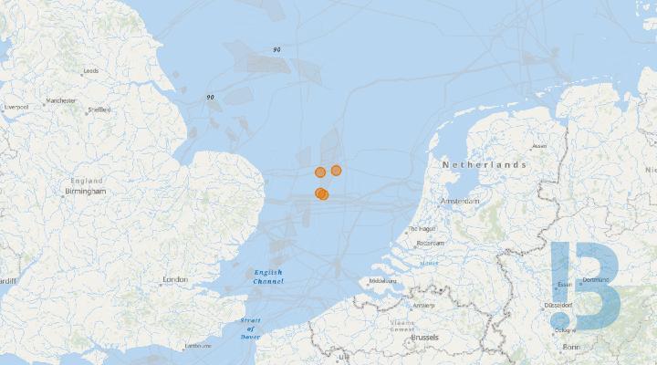
Crew Transfer Vessel NR Hunter - East Anglia Three Offshore Windfarm Array
Please be advised that the crew transfer vessel ‘NR Hunter’ is expected to mobilise in the port of Lowestoft Circa 15/08/2025
Crew Transfer Vessel NR Hunter will provide assistance during the construction phase of the East Anglia THREE Offshore Windfarm Array and will make regular transits between East Anglia THREE CDM and the ports of Lowestoft and Great Yarmouth. Outer Thames Estuary Special Protection Area (SPA): As required under Deemed Marine License Condition 13(1)(c)(v) to minimise disturbance to red throated diver in the Outer Thames Estuary Special Protection Area (SPA) during construction of East Anglia THREE, these areas shall as far as practicable be avoided during transits from 01st November to 31st March.
It is currently anticipated that weather permitting, operations will be carried out on a continuous basis (i.e. 24-hour working, seven days a week) ‘NR Hunter’ will remain on the project until construction is complete
See detailed map on our bulletin website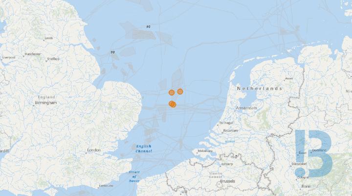
Crew Transfer Vessel NR Rebellion - East Anglia Three Offshore Windfarm Array
Please be advised that the crew transfer vessel ‘NR Rebellion’ is expected to mobilise in the port of Lowestoft circa 01/04/2024
Crew Transfer Vessel NR Rebellion will provide assistance during the construction phase of the East Anglia Three Offshore Windfarm Array and will make regular transits between East Anglia Three CDM and the ports of Lowestoft and Great Yarmouth. Outer Thames Estuary Special Protection Area (SPA) As required under Deemed Marine License Condition 13(1)(c)(v) to minimise disturbance to red throated diver in the Outer Thames Estuary Special Protection Area (SPA), during construction of EA3. It is anticipated that vessels which are transiting to Lowestoft and Great Yarmouth ports, such as for crew transfer operations, will transit through and/or in proximity to the Outer Thames Estuary SPA. These areas shall be as far as practicable be avoided during transit from 01st November to 31st March
See detailed map on our bulletin website
Notification of Guard Vessel - East Anglia Three Offshore Windfarm
Mariners are hereby advised that circa the 01/03/2025 the guard vessel Tess will commence guard duty operations at the East Anglia Three Offshore Windfarm area set out in section 2 of the attached Notice to Mariners.
The guard vessel ‘Tess’ will monitor vessel traffic in and around the East Anglia Three Offshore Windfarm 24hours a day, 7 days a week. The vessel will broadcast regular navigational warnings and will contact any non-project vessels they believe could cause potential hazards, risk of collision, or cause an interruption to project vessels or assets. She will be monitoring VHF Channel 16 and VHF DSC Channel 70 continuously throughout the operaton.
See detailed map on our bulletin website
Aids To Navigation Demarcation Buoys - East Anglia THREE Offshore Windfarm
Mariners are advised that the Trinity House buoy Installation Vessel ‘Patricia’ has relocated four navigational buoys marking the boundary of the East Anglia THREE Offshore Windfarm.
THV Patricia has relocated the EA3 East 1 Buoy, EA3 East 2 Buoy, EA3 East Buoy 3 and the EA3 Special 3 Buoy marking the boundary of the East Anglia THREE Offshore Windfarm Array.
The demarcation buoys will remain on station throughout construction of the East Anglia THREE Offshore Windfarm.
For futher information regarding East Anglia THREE aids to navigation, please see attached EA3 Notice To Mariners 080- 2025 - Aids To Navigation – Demarcation Buoys.
See detailed map on our bulletin website
Commencement of Construction of East Anglia Three Offshore Windfarm
Please be advised from circa 1st November 2024 East Anglia Three Offshore Windfarm construction works will commence, subsea boulder and debris clearance operations will be the first construction activity as per the attached NTM document. Followed by Scour protection Installation circa 05th November 2024 as per NTM 050 in attachment.
East Anglia THREE will be a large offshore wind farm, located 69 km off the Norfolk coast. With a projected capacity of approximately 1400MW, the wind farm shall supply electricity to approximately one million UK homes. Onshore construction for the project started in July 2022.
By use of multiple specialized offshore vessels,1 Offshore Convertor station (OFCS) & 95 offshore wind turbine generators (WTGs) will be installed within the East Anglia Three site boundary along with the associated inter array and export cables. The generated power will be transmitted via an installed External Cable (EC) from the OFCS to a shore side substation located in Bramford.
See detailed map on our bulletin website
Hazard Notice Dangerous Object – Debris / Lost Equipment
Advising Mariners of three lost CPT (cone penetration test) cones from the NG Driller within Notice to Mariners – Block 1 - Nearshore Surveys.
Following the commencement of the EGL2 nearshore English geotechnical investigation (GI) campaign along the EGL2 survey corridor, SSENT and NGET are advising Mariners of the loss of three CPT (cone penetration test) cones from the NG Driller within Notice to Mariners – Block 1 – Nearshore Surveys.
See detailed map on our bulletin website
Wind Turbine Generator Commissioning Campaign - East Anglia THREE offshore windfarm
Mariners are advised that the Commissioning “Walk to Work” (W2W) Vessel IWS Windwalker and supporting Crew Transfer Vessels (CTVs) Fob Swath 6 and Fob Swath 7 will commence Wind Turbine Generator (WTG) commissioning operations within the East Anglia THREE offshore windfarm area circa the 18/03/2026. Operations will be conducted by Siemens Gamesa Renewable Energy (SGRE). The main working area will be as detailed in Attached EAT NTM 008-2026 Wind Turbine Generator Commissioning Campaign.
IWS Windwalker and supporting CTVs will commission 95 WTGs at the locations set out in section 2.2 ofEAT NTM 008-2026 Wind Turbine Generator Commissioning Campaign.Installed WTGs shall be marked with the following aids to navigation:LightsFl Y 2.5s light (visible through 360°)Minimum 2 nm range
Partially constructed monopiles shall be marked with the following aids to navigation where a transition piecehas not been installed:
LightsFl Y 2.5s light (visible through 360°)Minimum 2 nm rangeWeather permitting, offshore works will be carried out on a continuous basis (i.e. 24-hour working, seven daysa week).During operations, the IWS Windwalker will have restricted manoeuvrability as defined under COLREGS(International Regulations for Preventing Collisions at Sea, 1972). They will display the appropriate day shapesand lights and will transmit an Automatic Identification System (AIS) message.
Program Schedule:The IWS Windwalker will mobilise at the Port of Lowestoft, with first commissioning activitiesanticipated to start around 18/03/202
The CTVs will mobilise at the Port of Lowestoft and support the IWS Windwalker throughout thecampaign.
WTG installation is expected to be completed end of Q4 2026.
See detailed map on our bulletin website
Boundary Buoy Installation As Laid - Dogger Bank C Offshore Wind Farm
The Trinity House Buoy Installation Vessel, Galatea, has installed the Dogger Bank C boundary demarcation buoys in the Southern North Sea.
The 17 construction boundary demarcation buoys will remain in location until the windfarm construction activities have been completed and handed over to the Operations and Maintenance teams.
Once the permanent Aids to Navigation (AtoN) have been installed on the WTGs, Trinity House will approve the permanent AtoN and the boundary buoys will be removed.
If anyone finds a buoy that is off station or encounters a buoy location where it is not functioning or is missing, they should report this to the Dogger Bank Duty Marine Coordinator as soon as possible.
See detailed map on our bulletin website
Foundation Transition Piece Installation - Inch Cape site boundary
All mariners and stakeholders are advised that WTG foundation transition piece installation activities shall commence within the Inch Cape site boundary.
On behalf of Inch Cape Offshore Ltd, Seaway 7 shall commence the installation of 54 WTG foundation transition piece components.
The transition pieces will be transported from the Port of Leith to the Inch Cape site and installed by the heavy lift vessel Seaway Alfa Lift.
Alfa Lift is expected to arrive at the Inch Cape site on or around the 17th of March to commence installation which will continue for several months, further details are in the attached notice to mariners.
See detailed map on our bulletin website
EA3 Offshore Windfarm NTM-007/2026 Wind Turbine Generator Installation Campaign.
Mariners are advised that the Jack Up Vessels Wind Osprey and Wind Pace will commence Wind Turbine Generator (WTG) installation operations within the East Anglia THREE offshore windfarm area. Marine operations will be conducted by Cadeler A/S and construction operations by Siemens Gamesa Renewable Energy (SGRE). The main working area will be inside the CDM Zone of the wind farm array.
Wind Osprey and Wind Pace will install 95 WTGs
Installed WTGs shall be marked with the following aids to navigation:
Lights
- Fl Y 2.5s light (visible through 360°)
- Minimum 2 nm range
Partially constructed monopiles shall be marked with the following aids to navigation where a transition piece has not been installed:
Lights
- Fl Y 2.5s light (visible through 360°)
- Minimum 2 nm range
Weather permitting, offshore works will be carried out on a continuous basis (i.e. 24-hour working, seven days a week).
During operations, the Wind Osprey and Wind Pace will have restricted manoeuvrability as defined under COLREGS (International Regulations for Preventing Collisions At Sea, 1972). They will display the appropriate day shapes and lights and will transmit an Automatic Identification System (AIS) message.
See detailed map on our bulletin website
Dangerous Object - Exposed Steel Wire Rope - Eastern Green Link 2 (73071)
Following EGL2 Nearshore UXO TI Campaign along the EGL2 survey corridor, SHET and NGET are advising Mariners of wet storage of a cut length of steel wire rope (SWR) protruding the seabed in the positions listed below. The remainder of the wire is buried beneath the seabed. The wire does not constitute a hazard to general navigation; however, it may present a risk to small vessels when anchoring.
- The steel wire rope sections are assumed to be remnants of discarded trawl wire or anchor cable and are now partially exposed above seabed level.
- The wire does not pose a hazard to general navigation.
- However, it may present a risk to small vessels when anchoring or operating gear near the seabed.
- A substantial amount of wire remains buried beyond each of the location ends detailed below.

Dogger Bank B WTG Installation
The Jack-up WTG Installation Vessel, Voltaire, will install wind turbine generators (WTG) within the Dogger Bank B construction area.
The works will commence around the 21st of February 2026 continuing until approximately Q2 2027. The works will be continuous, 24 hours a day. A chart of the DBB construction area boundary coordinates and a table of WTG location coordinates is provided below. A running list of the completed WTG installations and the next locations to be installed is presented in the Weekly Notice of Operations.
During operations, the Voltaire will be restricted in its ability to manoeuvre as defined under COLREGs (International Regulations for Preventing Collisions at Sea 1972) and will display the appropriate day shapes and lights. The vessel will also transmit an Automatic Identification System (AIS) message.
During operations, a Statutory Safety zone of 500m radius will be in place around the Voltaire during the installation of WTGs
See detailed map on our bulletin website
Wave Rider Buoy - East Anglia THREE Offshore Windfarm
Mariners are advised that Seaway 7 have deployed a Wave Rider Buoy within the East Anglia THREE Offshore Windfarm Area
Seaway 7 deployed a Wave Rider Buoy on the 01/05/2025 within the boundary of the East Anglia THREE Offshore Windfarm Array during the Monopile Noise monitoring campaign as referenced in EA3 NTM 026 - 2025 Monopile Installation (Noise Monitoring Buoy Deployment). The Wave rider Buoy will remain on station until the end of the project.
The Wave Rider Buoy is equipped with a flashing yellow light and has a range of four nautical miles.
Recovery and/or periodic maintenance of the Wave Rider Buoy will be notified via future Notice to Mariners
See detailed map on our bulletin website

Maintenance And Redeployment Of Weather Monitoring Buoy - East Anglia Three Offshore Wind Farm
Please be advised that Partrac Ltd have completed maintenance on the Northern weather monitoring buoy, installed within the East Anglia Three Offshore Wind Farm Area.
Positions for both North & South weather buoys are identified in the attached Notice To Mariners 005 -2025. There will be periodic maintenance for both weather buoys during construction of EA3.
There is an exclusion zone of 100m around the weather buoys, mariners are advised to abide by the 100m safety zone and navigate with caution at all times.
See detailed map on our bulletin website
Dogger Bank C Maintenance and Asset Preservation
The Service Operational Vessel, IWS Sun Walker, will carry out Balance of Plant (BoP) and Asset Preservation operations within Dogger Bank C construction site.
The works will be performed in a single campaign, commencing on the 7th of December 2025 and continuing until approximately Q4 2026. The works will be continuous, 24 hours a day. The operations will include visual inspections and remedial maintenance at the Offshore Substation Platform (OSP) and at installed WTG foundation locations. During operations, the IWS Sun Walker will be restricted in its ability to manoeuvre as defined under COLREGs (International Regulations for Preventing Collisions at Sea 1972) and will display the appropriate day shapes and lights. The vessel will also transmit an Automatic Identification System (AIS) message. It is requested that all vessels maintain a minimum of 500m separation distance from the SOV and pass at reduced speed. Fishing gear or other equipment with seabed intervention should not be deployed when approaching the working area.
See detailed map on our bulletin website



Disclaimer
TO DOWNLOAD THIS FILE, YOU MUST AGREE TO THE TERMS AND CONDITIONS "TERMS" NOTED AT THE FOOT OF THIS WEBSITE WHICH APPLY TO YOUR USE OF THIS WEBSITE AND TO USE OF THE FILE YOU HAVE CLICKED TO DOWNLOAD. IF YOU DO NOT AGREE TO THE TERMS, YOU WILL NOT BE ABLE TO DOWNLOAD THE FILE AND YOU SHOULD NOT USE THIS WEBSITE. TO CONFIRM YOUR ACCEPTANCE OF THE TERMS AND TO COMMENCE THE DOWNLOAD OF THE FILE, PLEASE CLICK THE "DOWNLOAD" CHECK BOX. IF YOU DO NOT AGREE TO THE TERMS, PLEASE CLICK THE "CANCEL" BUTTON. YOUR ATTENTION IS DRAWN TO CONDITION 3 NOTED BELOW WHICH FORMS PART OF THE TERMS IN RELATION TO OUR LIABILITY TO YOU.
Agree and download Cancel